Across the Seedamm from Pfäffikon to Rapperswil
4.8 kilometres with an elevation range of just eleven metres: this walk leads from Pfäffikon at 412 metres via Hurden and the Seedamm causeway to Rapperswil. One hour, practically without a climb and with water on both sides.
The route from above
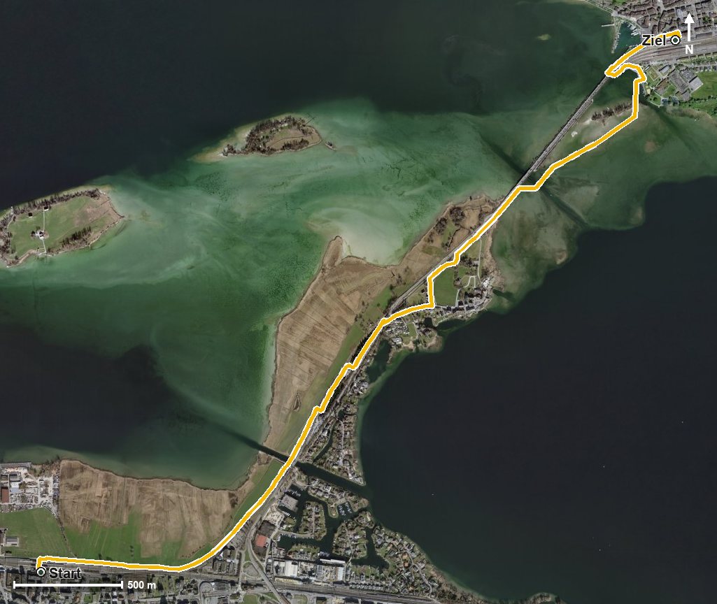
Open interactive map (zoom and pan)
Elevation profile
Route description
The starting point is Pfäffikon SZ, which is also the highest point of the route. The path leads onto the Hurden peninsula, reached at kilometre 1.5.
From there the route crosses Lake Zurich at its narrowest point and reaches Rapperswil at kilometre 4.1. The walk ends at 410 metres.
The lowest point lies at 401 metres; the steepest section is two per cent. There are no climbs worth mentioning.
Technically the route makes no demands and suits all ages, including with a pushchair. It can be walked from March to October. Both ends are served by rail, which makes planning particularly easy.
Grading
Good to know
Getting there / public transport
By public transport to Pfäffikon SZ. Current timetable at sbb.ch.
Food and drink
No refreshment stop is recorded along the route. Food and drink are available in Pfäffikon at the start, in Hurden at kilometre 1.5 and in Rapperswil at the finish.
Best time of year
Recommended: Mar, Apr, May, Jun, Jul, Aug, Sep, Oct