From Goldau over the Gnipen and the Wildspitz to Sattel
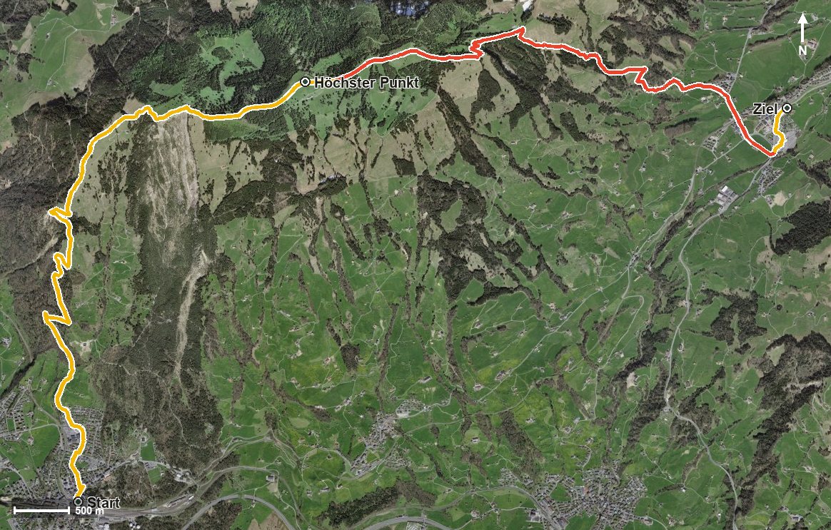
From Goldau station at 509 metres up to the Wildspitz at 1,555 metres and back down to Sattel: this stage demands 1,183 metres of ascent and 898 metres of descent over 13.4 kilometres. A challenging full-day tour for fit and sure-footed hikers.
The route from above
Open interactive map (zoom and pan)
Elevation profile
Route description
It starts right at Goldau station, which makes getting there as easy as it gets. After just 400 metres the climb begins and hardly lets up until kilometre 5.9: in three successive pushes of 475, 123 and 444 metres, the path gains around a thousand metres of height across the Kienbach.
At kilometre 5.9 the Gnipen is reached, the mountain from which the Goldau rockslide broke away in 1806. Shortly afterwards, at kilometre 7.1, comes the highest point of the stage at 1,555 metres by the Wildspitz, high above the Hürital.
The second part leads down through the Chessel, crosses the Änderenbach and reaches Sattel at kilometre 11.6. The steepest passage lies at kilometre 4.1 at around 31 per cent. Some sections require a sure step and sturdy footwear.
For breaks there are the Berggasthaus Wildspitz at the highest point and the Alpwirtschaft Halsegg at kilometre 9.5. The tour is recommended from April to October. It is part of the Schwyzer Höhenweg, a regional long-distance route, and passes through the municipalities of Arth, Steinerberg and Sattel.
Grading
Good to know
Getting there / public transport
By public transport to Arth-Goldau; the hike begins right at the station. Current timetable at sbb.ch.
Food and drink
Berggasthaus Wildspitz at kilometre 7.1 and Alpwirtschaft Halsegg at kilometre 9.5.
Best time of year
Recommended: Apr, May, Jun, Jul, Aug, Sep, Oct