From Innerthal up to the Bockmattli hut
598 metres of ascent in only 4.6 kilometres: this short but steep climb leads from Innerthal on the Wägitalersee at 906 metres up to the Bockmattli hut at 1,500 metres. Two hours with a passage at a 24 per cent gradient.
The route from above
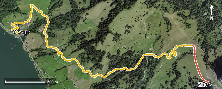
Open interactive map (zoom and pan)
Elevation profile
Route description
The starting point is Innerthal at the far end of the Wägitalersee, at the Sehrhalten. The path gains 82 metres over the first 900 metres, after which the main climb of 509 metres begins from kilometre 1.0 at the Dunkelboden.
Via the Oberer Heuboden and the Heubödeli the route climbs steeply. The path crosses the Lauelibach at kilometre 3.3; the steepest passage is 24 per cent at kilometre 3.7.
After the Trepsental and the Chälen, the Bockmattli hut is reached at kilometre 4.6 at 1,500 metres, the highest point of the tour and the only refreshment stop recorded. The elevation range is 594 metres.
Several sections require a sure step and sturdy footwear. Because the climb covers almost 600 metres of ascent in four and a half kilometres, it calls for good basic fitness. Because of the altitude the tour can only be walked from June to September; it is worth checking the hut's opening times in advance.
Grading
Good to know
Getting there / public transport
By public transport into the Wägital to Innerthal. Current timetable at sbb.ch.
Food and drink
Bockmattlihütte at the finish, the only refreshment stop recorded. Provisions for the climb belong in the rucksack.
Best time of year
Recommended: Jun, Jul, Aug, Sep