Loop from the Wägitalersee up the Himelchopf
746 metres of ascent in one go, straight up from the lakeshore: this loop from the Wägitalersee at 918 metres leads up the Himelchopf at 1,782 metres. 10.1 kilometres, four and a half hours and a passage with a 34 per cent gradient right at the beginning.
The route from above
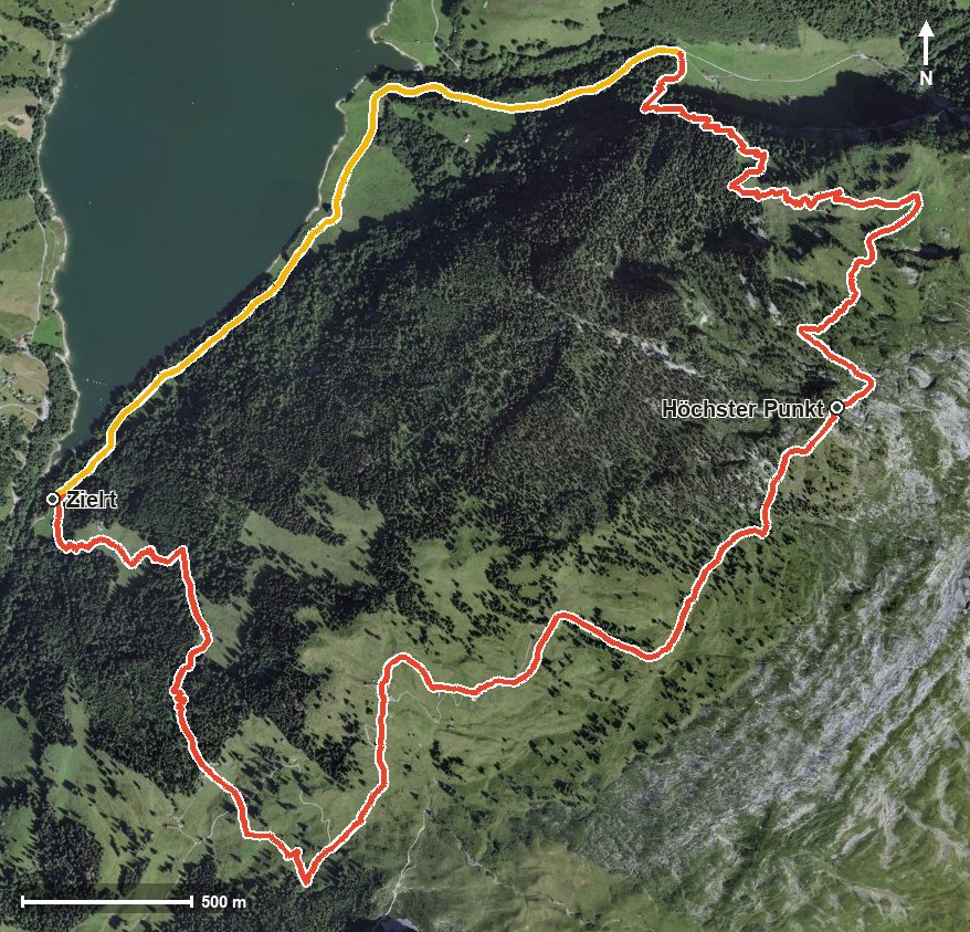
Open interactive map (zoom and pan)
Elevation profile
Route description
The starting point is the Wägitalersee, where the path crosses the Aberenbach. The climb begins at once and gains around 746 metres by kilometre 4.0. The steepest passage comes as early as kilometre 0.5 and reaches around 34 per cent.
At kilometre 2.1 the Lufthütte invites you to a break, the only inn recorded on the route. After a further climb of 107 metres, the Himelchopf is reached at kilometre 4.8 at 1,782 metres, the highest point of the loop.
The way back leads over the Steinlaueli and crosses the Ziggenbach at kilometre 7.6 before returning to the starting point. The elevation range is 865 metres.
Some sections require a sure step and sturdy footwear. Because of the altitude the loop can only be walked from June to September. Provisions for the way belong in the rucksack.
Grading
Good to know
Getting there / public transport
By public transport into the Wägital to the Wägitalersee. Current timetable at sbb.ch.
Food and drink
Lufthütte at kilometre 2.1, the only refreshment stop recorded along the loop.
Best time of year
Recommended: Jun, Jul, Aug, Sep