Loop around the Glattalpsee
A high-valley loop at almost 1,900 metres: from the valley station of the Glattalp cable car, 13.3 kilometres lead up to the Glattalpsee and around the high valley, which is regarded as one of the coldest inhabited places in Switzerland. 838 metres of ascent, most of it right at the beginning.
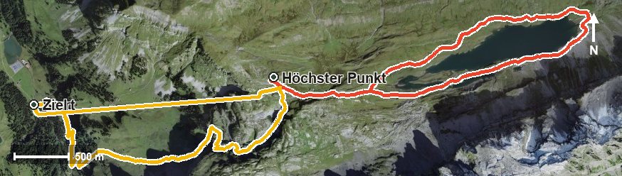
The route from above
Open interactive map (zoom and pan)
Elevation profile
Route description
The starting point is the valley station of the Glattalp cable car at Sahli at 1,146 metres, where the path crosses the Muota. From here it gets straight down to business: by kilometre 3.4 there are 636 metres of ascent to overcome; the steepest passage lies at kilometre 2.2 and reaches around 30 per cent.
After another short climb the highest point is reached at kilometre 4.3 at 1,891 metres. The route then leads through the Seeloch and over the Läcki into the high valley and reaches the Seeboden on the Glattalpseebach at kilometre 7.7.
The way back follows the loop around the high valley and leads to the top station. From there the Glattalp cable car takes care of the entire descent and carries walkers from 1,866 down to 1,153 metres, which takes much of the sting out of the tour.
Some sections call for a sure step; sturdy footwear is part of the kit. Because of the altitude the loop can only be walked from June to September. No refreshment stop is recorded along the route, so provisions and drinks belong in the rucksack.
Grading
Good to know
Getting there / public transport
By public transport into the Bisistal to the stop «Sahli-Glattalp», then by the Glattalp cable car. Current timetable at sbb.ch.
Food and drink
No refreshment stop is recorded along the route. Take provisions for the whole day.
Best time of year
Recommended: Jun, Jul, Aug, Sep