Loop from Schlänggen in the Bisistal
A manageable loop at the head of the Muotatal: 10.5 kilometres from Schlänggen in the Bisistal at 1,090 metres, with 523 metres of ascent and an elevation range of 413 metres. Three and a half hours and two refreshment stops right at the beginning.
The route from above
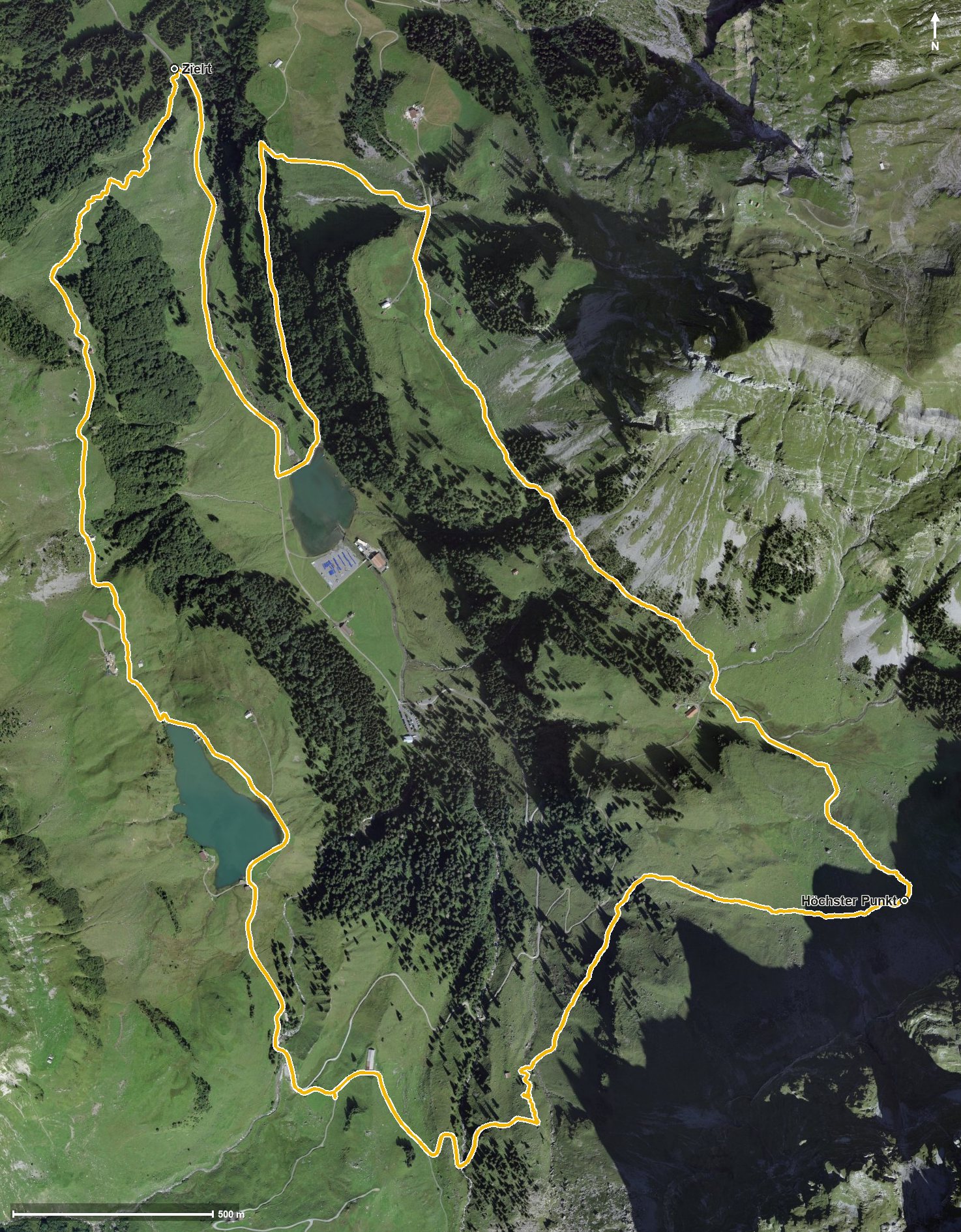
Open interactive map (zoom and pan)
Elevation profile
Route description
The starting point is Schlänggen in the Bisistal. The climb begins at once and gains 309 metres over the first 1.9 kilometres; the steepest section is 31 per cent, right at kilometre 0.2.
At kilometre 1.0 the Vordersten Hütten invite you to a break, and at kilometre 1.5 the Steinhütte. The path then crosses the Waldibach, the Ruosalper Bach and the Gwalpetenbach.
From kilometre 4.8 a second climb of 118 metres follows, leading to the highest point at kilometre 5.6 at 1,501 metres. The way back crosses the Milchbüelenbach at kilometre 6.3 and the Muota at kilometre 9.3 and closes back at the starting point.
Technically the path remains straightforward; sturdy footwear is enough. The steep start, though, calls for a little fitness. The loop can be walked from May to October.
Grading
Good to know
Getting there / public transport
By public transport into the Bisistal to the Schlänggen stop. Current timetable at sbb.ch.
Food and drink
Vordersten Hütten at kilometre 1.0 and Steinhütte at kilometre 1.5.
Best time of year
Recommended: May, Jun, Jul, Aug, Sep, Oct