Loop from the Rotenflue between the Mythen
A compact loop with a twist: it passes between the two Mythen and enlists the cable car for the way back. Seven kilometres, 466 metres of ascent and two and a half hours, with the entire climb falling in the last third.
The route from above
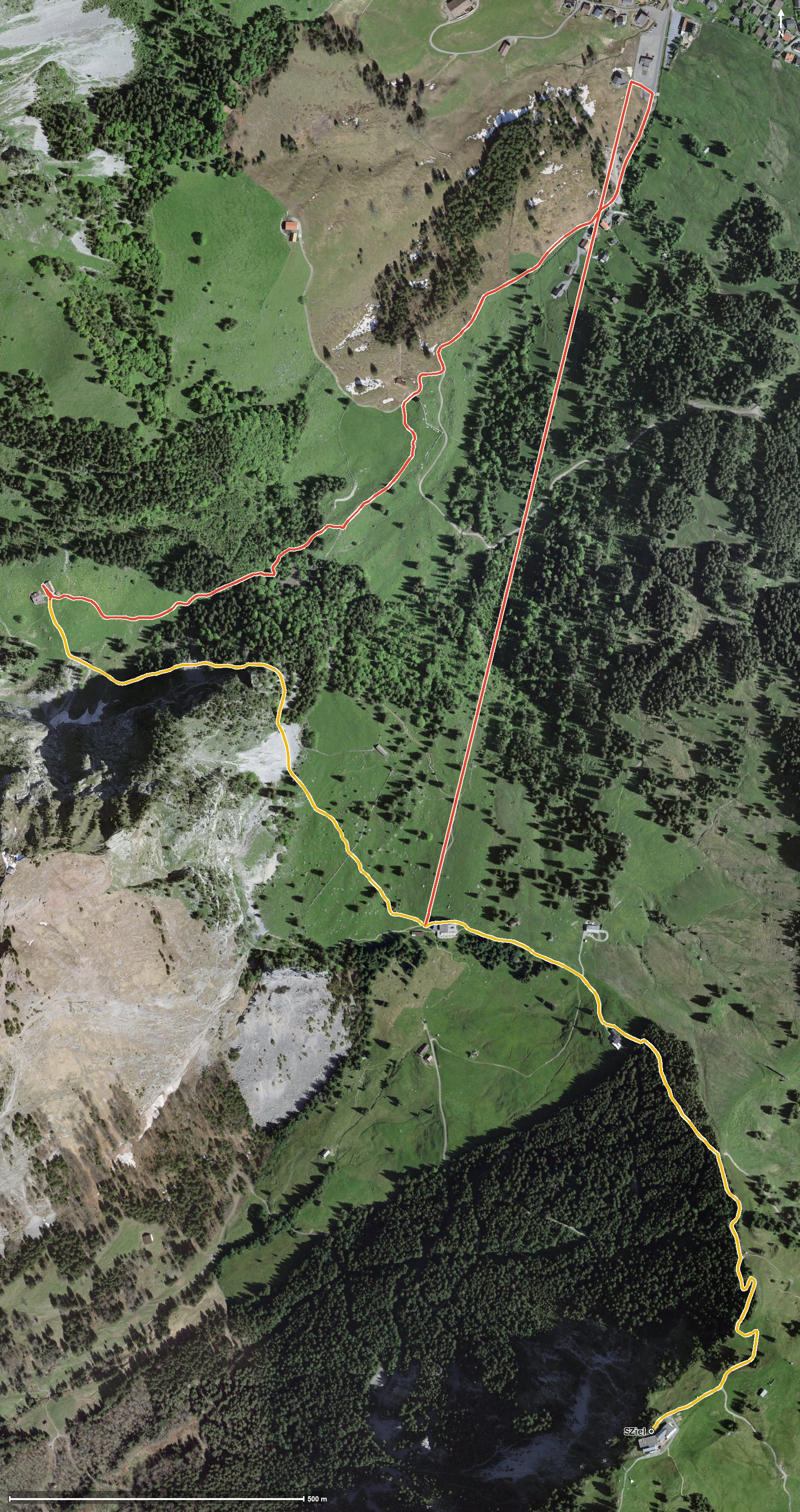
Open interactive map (zoom and pan)
Elevation profile
Route description
The starting point is the Rotenflue top station at 1,571 metres, which is also the highest point of the loop. The path runs high above the Alptal and the Zwäckentobel and descends steadily. At kilometre 2.5 the Alpwirtschaft Zwüschet Mythen is reached, which owes its name to its position between the Grosser and Kleiner Mythen.
Via Gspaa it continues down to 1,100 metres, the lowest point of the tour. From kilometre 4 the way back begins with 453 metres of ascent in one go. At kilometre 5.6 a cable car takes on part of the climb and carries walkers from 1,100 to 1,397 metres up to the Holzegg.
The final section leads across the Tobelbach and the Stäglerenegg back to the Rotenflue. The steepest passage lies at kilometre 4.1 and reaches around 20 per cent. Some sections call for a sure step.
There are plenty of places to stop: the Restaurant Gipfelstubli at the start, the Skihaus Holzegg at kilometre 1, the Alpwirtschaft Zwüschet Mythen at kilometre 2.5 and the Berggasthaus Holzegg at kilometre 5.6. Because of the altitude the loop is mainly walkable from June to October.
Grading
Good to know
Getting there / public transport
By public transport to Rickenbach, then the Rotenflue cable car to the top station. Current timetable at sbb.ch.
Food and drink
Restaurant Gipfelstubli at the start, Skihaus Holzegg at kilometre 1, Alpwirtschaft Zwüschet Mythen at kilometre 2.5 and Berggasthaus Holzegg at kilometre 5.6.
Best time of year
Recommended: Jun, Jul, Aug, Sep, Oct