Loop on the Glattalp over the Pfaffenkreuz
A high-mountain loop that stays above 1,840 metres throughout: eight kilometres, 390 metres of ascent and a saddle at 2,062 metres. Because the Glattalp cable car takes care of the approach, the hike begins right in the high valley.
The route from above
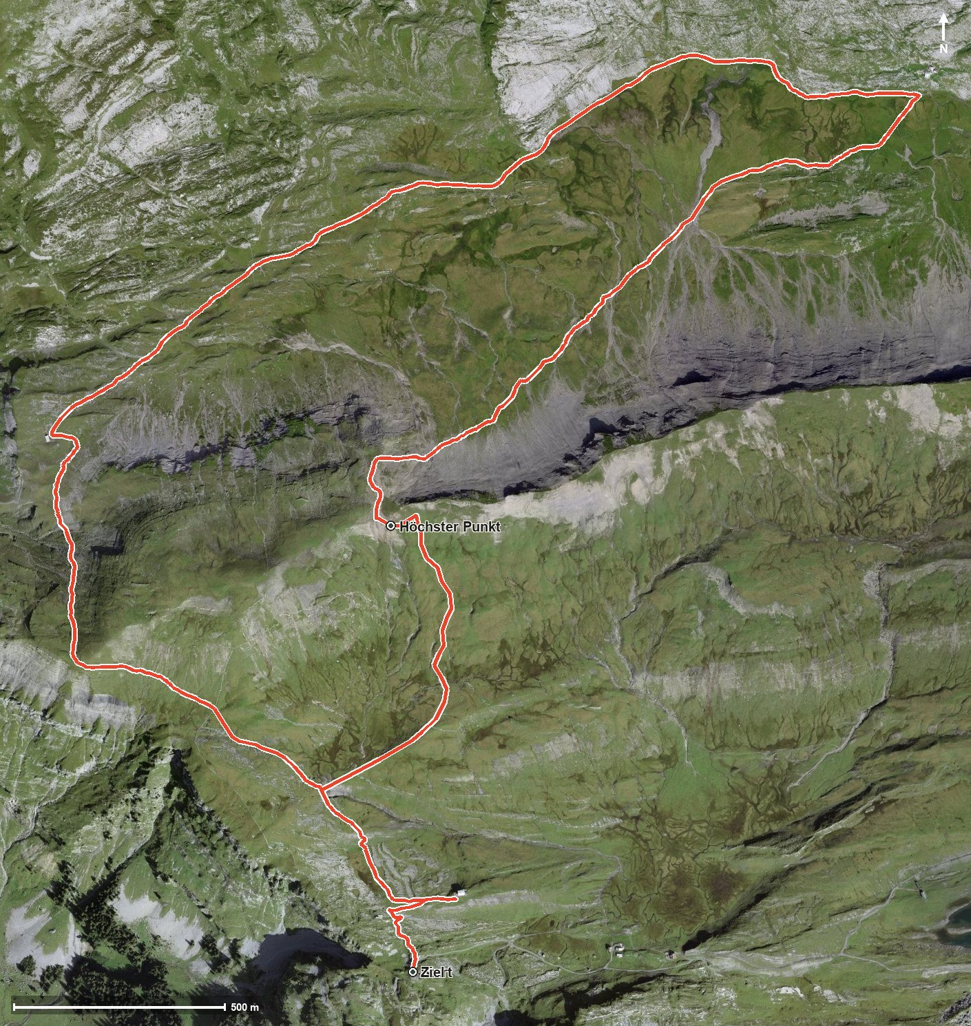
Open interactive map (zoom and pan)
Elevation profile
Route description
The starting point is the top station of the Glattalp cable car at 1,866 metres, high above the Bisistal. After just half a kilometre the first climb of 154 metres begins and lasts until kilometre 1.8, where the highest point of the loop is reached at the Pfaffenkreuz at 2,062 metres.
The path then descends into the Graben to 1,844 metres, the lowest point. From kilometre 5.5 the second climb of 148 metres follows back to the starting point. There are a mere 218 metres between the lowest and highest points, so the profile stays even overall.
The steepest passage lies at kilometre 1.2 and reaches around 22 per cent. A sure step is needed on the whole route, and sturdy footwear is essential. Because of the altitude the loop can only be walked from June to September.
No refreshment stop is recorded along the route, so provisions and plenty to drink belong in the rucksack. At this altitude the weather can change quickly, so it is worth checking the forecast before setting off.
Grading
Good to know
Getting there / public transport
By public transport into the Bisistal to the stop «Sahli-Glattalp», then by the Glattalp cable car into the high valley. Current timetable at sbb.ch.
Food and drink
No refreshment stop is recorded along the route. Take provisions for the whole day.
Best time of year
Recommended: Jun, Jul, Aug, Sep