A short loop from the Unter Roggenloch
3.4 kilometres, one hour and 191 metres of ascent: this short loop starts at the Unter Roggenloch on the Pragel road at 1,525 metres. Despite the short distance the path is demanding and calls for a sure step.
The route from above
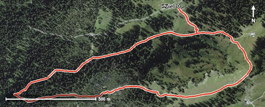
Open interactive map (zoom and pan)
Elevation profile
Route description
The starting point is the Unter Roggenloch, where the alpine inn of the same name stands right at the start. The climb begins at once and gains 102 metres over the first 700 metres; the steepest section is 17 per cent, as early as kilometre 0.1.
At kilometre 0.7 the highest point of the loop is reached at 1,633 metres. The path continues through the karst area above the Bisistal and drops to 1,501 metres.
The elevation range is a mere 132 metres, but the terrain is rough. Several sections require a sure step and sturdy footwear.
Because of the altitude and the approach over the Pragel road, the loop can be walked from May to October. Given its short distance, it combines well with a longer tour in the area.
Grading
Good to know
Getting there / public transport
Travel into the Muotatal and on over the Pragel road to the Unter Roggenloch. The road is open seasonally; current timetable at sbb.ch.
Food and drink
Alpwirtschaft Unter Roggenloch at the start and finish, the only refreshment stop recorded.
Best time of year
Recommended: May, Jun, Jul, Aug, Sep, Oct