A small loop from Muotathal by the Hölloch
Four kilometres, one hour and 126 metres of ascent: this short loop from Muotathal at 659 metres suits a relaxed afternoon. The elevation range is a mere 106 metres; the steepest section is twelve per cent.
The route from above
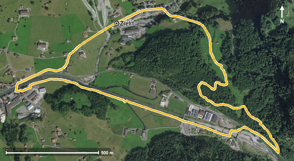
Open interactive map (zoom and pan)
Elevation profile
Route description
The starting point is Muotathal by the Hölloch, where the path crosses the Starzlenbach straight away. Over the first 900 metres the route gains 69 metres, and at kilometre 1.1 the highest point is already reached at 733 metres.
Past the entrance to the Bisistal the path continues and crosses the Muota at kilometre 1.7. At kilometre 2.0 the Hüttenhotel Husky-Lodge invites you to a break, the only refreshment stop recorded on the loop.
Via Hinterthal at the entrance to the Hürital the loop closes back at the starting point. The lowest point lies at 627 metres.
Technically the walk makes no demands and is therefore suitable for families with children too. It can be walked from May to October. Food and drink are also available in Muotathal at the start and finish.
Grading
Good to know
Getting there / public transport
By public transport to Muotathal, Hölloch. Current timetable at sbb.ch.
Food and drink
Hüttenhotel Husky-Lodge at kilometre 2.0. Further food and drink are available in Muotathal at the start and finish.
Best time of year
Recommended: May, Jun, Jul, Aug, Sep, Oct