Long-distance trail around Lake Lucerne
113.8 kilometres and 4,272 metres of ascent: this long-distance trail leads from Brunnen at 434 metres once around Lake Lucerne and back to the lakeshore. With thirty-five hours of walking it is designed for several days.
The route from above
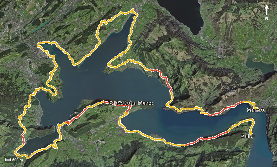
Open interactive map (zoom and pan)
Elevation profile
Route description
The starting point is Brunnen at the boat landing. The first section leads over the Geisstal to Gersau at kilometre 7.6 and on via Unter Linden to Vitznau at kilometre 15.2.
Via Weggis at kilometre 22.8, Greppen and Küssnacht am Rigi at kilometre 30.4 and the Allmig, the route heads towards Lucerne. The individual climbs remain manageable at 92 to 504 metres and are spread over the whole route.
The biggest climb lies between kilometres 80.7 and 88.5 with 504 metres of ascent; the steepest passage is 35 per cent at kilometre 84.3. At kilometre 89.4 the highest point is reached at 1,064 metres, and through the Rotzschlucht the path leads back to the lake.
The trail ends at the Uri end of Lake Lucerne at 435 metres. The elevation range is a mere 631 metres; the challenge lies in the length.
The route calls for good fitness and careful planning of stages and accommodation. Some sections require a sure step and sturdy footwear. Because the route runs along the lake throughout, individual stages combine well with a boat trip. It can be walked from May to October.
Grading
Good to know
Getting there / public transport
By public transport or boat to Brunnen; the hike starts at the lake. Current timetable at sbb.ch.
Food and drink
No individual refreshment stops are recorded on the long route. Food, drink and accommodation are available in Brunnen, Gersau, Vitznau, Weggis, Küssnacht and the other places on the lake.
Best time of year
Recommended: May, Jun, Jul, Aug, Sep, Oct