From Muotathal over the Huser Stock to Brunnen
27.9 kilometres, 1,784 metres of ascent, 1,976 metres of descent and ten hours of walking: this stage is the longest and most demanding in the whole collection. It leads from Muotathal at 626 metres over the Huser Stock all the way down to Brunnen on Lake Lucerne.
The route from above
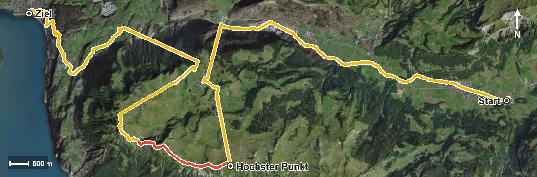
Open interactive map (zoom and pan)
Elevation profile
Route description
It starts at the Hintere Brücke bus stop in Muotathal, where the path follows the Muota and the Hüribach into the Hürital. Via the Bürgelibach and Ried the route slowly gains height before the big climb begins from kilometre 8.2: 1,345 metres of ascent by kilometre 13.5.
This passage is a tough one. The steepest section lies at kilometre 8.7 and reaches around 50 per cent, the highest figure in the entire collection. Two lifts take on part of the height on the way, first from 552 to 1,304 metres, then from 1,346 to 1,927 metres, where the highest point is reached at kilometre 13.1.
High above the Riemenstalden valley and a series of ravines, the path continues to the Huser Stock at kilometre 15.5. The long final part descends via Rüti, Nägelisgärtli and Boden to 435 metres in Brunnen, with several sections bridged by cable cars.
With an elevation range of 1,493 metres and almost 28 kilometres, the stage calls for fitness, a sure step and careful time planning. On the way the Fyrabigbeizli Nägelisgärtli at kilometre 22.9 invites you to a break. The tour is recommended from June to October.
Grading
Good to know
Getting there / public transport
By public transport to the stop «Muotathal, hintere Brücke». Current timetable at sbb.ch.
Food and drink
Fyrabigbeizli Nägelisgärtli at kilometre 22.9. No refreshment stop is recorded on the long middle section, so take provisions for the whole day.
Best time of year
Recommended: Jun, Jul, Aug, Sep, Oct