Mountain hike from Altdorf to Muotathal
1,615 metres of difference between the highest and lowest points: this full-day tour leads from the Tell monument in Altdorf at 458 metres over a 2,073-metre pass across to Muotathal. 22.3 kilometres and eight and a half hours that presuppose long hiking experience.
The route from above
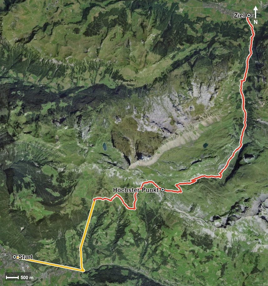
Open interactive map (zoom and pan)
Elevation profile
Route description
The starting point is the Tell monument in Altdorf, which is served by a bus stop. The path crosses the Schächen at kilometre 3.0 and reaches Bürglen at the entrance to the Schächental and the Riedertal.
Between kilometres 3 and 6, according to the route data, cable cars bridge a substantial part of the climb, first from 458 to 648 metres, then from 646 to 1,006 and finally from 1,006 to 1,726 metres. On foot there are 618 metres of ascent to overcome on this section; the steepest passage is 44 per cent at kilometre 3.2.
Via the Mättental, the Vorderer Weissenboden and Wiltschi the route continues and, after another 342 metres of ascent, reaches the highest point at kilometre 10.7 at 2,073 metres. Then the long descent begins through the Hürital and the Chinzertal.
The path crosses the Chinzerbach, the Wängibach and the Hüribach, passes the Vordersten Hütten at kilometre 15.9, the only refreshment stop recorded, and leads down through the Laui and the Mattentobel. At kilometre 22.3 the hike ends after crossing the Muota in Muotathal at 626 metres.
With 22 kilometres and 1,669 metres of ascent, the tour calls for very good fitness, and several sections require a sure step and sturdy footwear. An early start, enough provisions and a look at the weather situation are part of the plan. It can be walked from June to October.
Grading
Good to know
Getting there / public transport
By public transport to Altdorf UR and on to the Telldenkmal stop. Current timetable at sbb.ch.
Food and drink
Vordersten Hütten at kilometre 15.9, the only refreshment stop recorded on the route. Food and drink are also available in Altdorf at the start and in Muotathal at the finish.
Best time of year
Recommended: Jun, Jul, Aug, Sep, Oct