From Biel-Kinzig through the Chinzertal to Muotathal
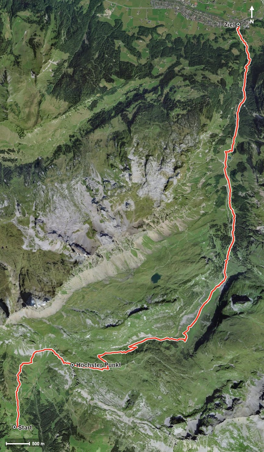
1,450 metres of descent in 14.4 kilometres: this tour starts at 1,623 metres at Biel above Bürglen, crosses a pass at 2,073 metres and leads down to Muotathal at 626 metres. A route that is predominantly downhill.
The route from above
Open interactive map (zoom and pan)
Elevation profile
Route description
The starting point is Biel-Kinzig high above the Schächental, where the Alphotel Biel-Kinzig stands right at the start. The only climb begins at once and gains around 429 metres by kilometre 3.0; the steepest passage is 30 per cent at kilometre 2.4.
Via Gadenstettli, the Vorderer Weissenboden and the Mättental the route reaches the highest point at kilometre 3.0 at 2,073 metres and there crosses into the Canton of Schwyz.
Then the long descent begins through the Chinzertal and the Hürital. The path crosses the Chinzerbach at kilometre 4.5 and the Wängibach at kilometre 7.2 and leads through the Laui. At kilometre 8.1 the Vordersten Hütten invite you to a break, shortly before the Grüen Boden.
After crossing the Hüribach and the Muota, the hike ends at kilometre 14.4 in Muotathal. The elevation range is 1,447 metres. Several sections require a sure step and sturdy footwear; the long descent is hard on the knees, and walking poles are a sensible aid. The tour can be walked from June to October.
Grading
Good to know
Getting there / public transport
By public transport to Bürglen UR and on by cable car to Biel-Kinzig. Current timetable at sbb.ch.
Food and drink
Alphotel Biel-Kinzig at the start and Vordersten Hütten at kilometre 8.1. Further food and drink are available in Muotathal at the finish.
Best time of year
Recommended: Jun, Jul, Aug, Sep, Oct