From Muotathal via Stoos to Morschach
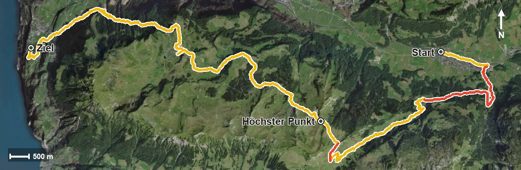
23.3 kilometres, 1,567 metres of ascent and eight and a half hours: this route leads from Muotathal at 610 metres over the high plateau at Stoos across to Morschach. Start and finish lie at almost the same height, with a climb of more than a thousand metres in between.
The route from above
Open interactive map (zoom and pan)
Elevation profile
Route description
The starting point is Muotathal at 610 metres, where the path follows the Muota and the Hofbach into the Hürital. There are already 302 metres of ascent to overcome in the first three kilometres; the steepest passage lies at kilometre 2.0 and reaches around 33 per cent.
From kilometre 3.2 the long main climb of 697 metres follows and continues until kilometre 10.2. On the way the route crosses the Helltobel, passes the Hellberg at kilometre 5.2 and leads through the Rambachtobel before the highest point is reached at kilometre 10.4 at 1,620 metres.
The second part leads across the Frontal to the car-free mountain village of Stoos at kilometre 16.1 and from there through a series of ravines, among them the Hölltobel, the Summerlaui and the Wissenfluetobel, down to Morschach at 632 metres.
Some sections require a sure step and sturdy footwear. At kilometre 7.8 Suterlis Hütte invites you to a break; otherwise no refreshment stop is recorded along the route. Given the length, start early and plan the return journey in advance. The tour is recommended from May to October.
Grading
Good to know
Getting there / public transport
By public transport to the stop «Muotathal, Schulhaus». Current timetable at sbb.ch.
Food and drink
Suterlis Hütte at kilometre 7.8. Further food and drink are available in the mountain village of Stoos at kilometre 16 and in Morschach at the finish.
Best time of year
Recommended: May, Jun, Jul, Aug, Sep, Oct