From Stoos over the Wannentritt down to Muotathal
From the car-free mountain village of Stoos at 1,301 metres down to Muotathal at 608 metres: with 1,243 metres of descent this route loses more than twice as much height as it gains. The 14.3 kilometres are manageable in terms of stamina, but the long descent takes its toll on the knees.
The route from above
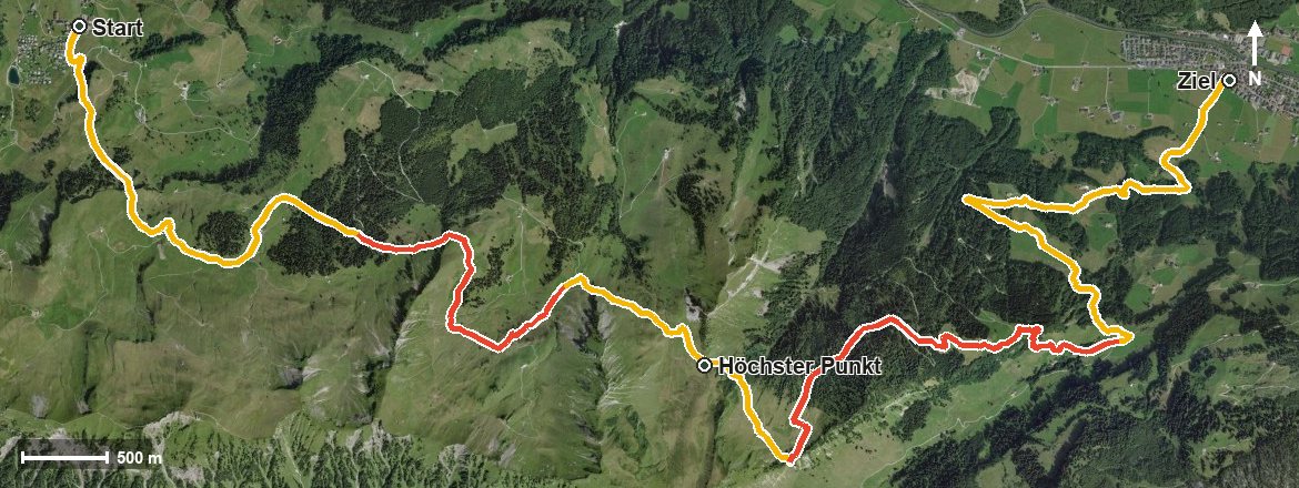
Open interactive map (zoom and pan)
Elevation profile
Route description
The starting point is the top station of the Schwyz–Stoos funicular. The path first climbs in three gentle sections, 551 metres of ascent in all, leading over the Metzg, crossing the Stoosbach and passing Bärhalten and the Loch.
After the Tröliger Bach and the Laubgartenbach, the highest point is reached at kilometre 6.4 at 1,620 metres. Shortly afterwards, at kilometre 7.3, the route crosses the Wannentritt and the Rambach.
From there it is downhill almost without interruption: through the Helltobel, across the Bürgelibach and Wysswand to Muotathal, reached at kilometre 14. There are 1,013 metres between the highest and lowest points. The steepest passage is 21 per cent at kilometre 5.4.
Some sections call for a sure step; sturdy footwear is part of the kit. No refreshment stop is recorded along the route, so provisions belong in the rucksack. The tour is recommended from April to October.
Grading
Good to know
Getting there / public transport
By public transport to Schwyz, then the funicular up to Stoos. Current timetable at sbb.ch.
Food and drink
No refreshment stop is recorded along the route. Take provisions; there are restaurants in the mountain village of Stoos at the start and in Muotathal at the finish.
Best time of year
Recommended: Apr, May, Jun, Jul, Aug, Sep, Oct