A long loop from Stoos
Eleven kilometres around the car-free mountain village of Stoos without a single steep climb: a long but consistently leisurely loop for half a day's walking. The 400-odd metres of ascent are spread over the whole route rather than bunched into one climb.
The route from above
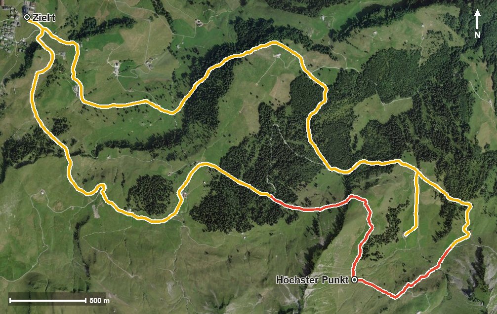
Open interactive map (zoom and pan)
Elevation profile
Route description
The starting point is the top station of the Schwyz–Stoos funicular at 1,306 metres. The loop passes Rämsen, crosses the Stoosbach and later the Tröliger Bach, and only gains noticeable height in the second third: between kilometres 4.9 and 6.6 there are around 150 metres to climb, after which the highest point follows at kilometre 6.5 at 1,564 metres.
The way back runs via Bärhalten and the Loch, touches the Metzg at kilometre 9 and shortly afterwards passes the Klingenstock chairlift before the loop returns to the mountain village. Along the way the tour switches between the municipalities of Morschach and Muotathal.
Some sections call for a sure step, but nowhere is it steeper than 13 per cent. That makes the tour easy to plan despite its length.
Because of the altitude, the loop is mainly walkable from June to September. The starting point is in the mountain village of Stoos; along the route itself no refreshment stop is recorded, so drinks and provisions belong in the rucksack.
Grading
Good to know
Getting there / public transport
By public transport to Schwyz and on by the Schwyz–Stoos funicular; the loop begins at the top station. Current timetable at sbb.ch.
Food and drink
No refreshment stop is recorded along the route. Food and drink are available in the mountain village of Stoos at the start and finish.
Best time of year
Recommended: Jun, Jul, Aug, Sep