Steep climb from Gersau up the Rigi Hochflue
1,250 metres of ascent in a single climb, from the lakeshore in Gersau at 435 metres up to 1,698 metres: this climb up the Rigi Hochflue is among the hardest tours in the collection. It calls for alpine experience, a sure step and an absolute head for heights.
The route from above
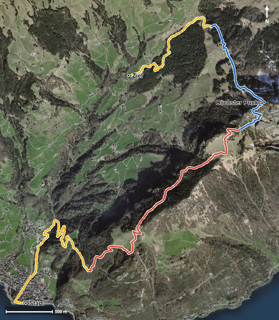
Open interactive map (zoom and pan)
Elevation profile
Route description
The starting point is Gersau, right on Lake Lucerne at 435 metres. After just 300 metres the path crosses the Innerer Dorfbach, after which the climb begins and does not let up until kilometre 6. On this stretch there are 1,250 metres of ascent to overcome, with practically no breather at all.
After the Röhrlisbach at kilometre 4.8 the route leads through the Chrummtobel and the Sulztal into ever steeper terrain. The steepest passage lies at kilometre 5.5 and reaches around 41 per cent. At kilometre 6.1 the summit of the Hochflue is reached at 1,698 metres, with 1,264 metres of elevation range between the lowest and highest points.
Some sections make considerably higher demands than an ordinary mountain hike. Alpine experience, a sure step, an absolute head for heights and a reliable sense of direction are essential. In wet conditions or with residual snow the tour is considerably trickier.
The descent leads via the Teuffibach to Ober Gschwend at 1,012 metres, where the hike ends after 8.8 kilometres. No refreshment stop is recorded along the route, so provisions and plenty to drink for the whole day belong in the rucksack. The tour is recommended from May to October.
Alpine hiking trail: alpine experience required
This route includes sections of alpine hiking trail. Only for experienced, sure-footed mountain walkers with a head for heights.
Grading
Good to know
Getting there / public transport
By public transport or boat to Gersau; the hike starts at the lakeshore. Current timetable at sbb.ch.
Food and drink
No refreshment stop is recorded along the route. Take provisions for the whole day; there are restaurants in Gersau at the starting point.
Best time of year
Recommended: May, Jun, Jul, Aug, Sep, Oct