Long-distance trail from Altdorf via Schwyz to the Entlebuch
207.9 kilometres and 14,557 metres of ascent: this long-distance trail leads from the Tell monument in Altdorf at 458 metres right across central Switzerland to Flühli at 1,153 metres. With seventy-eight and a half hours of walking it is designed for many days.
The route from above
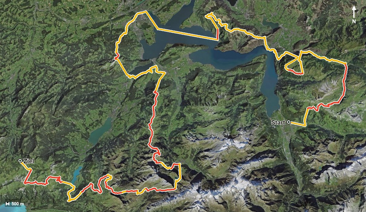
Open interactive map (zoom and pan)
Elevation profile
Route description
The starting point is the Tell monument in Altdorf. The first section leads via the Schächental and the Chinzertal into the Muotatal, reached at kilometre 23.1 after crossing the Muota.
It then continues over Stoos and the Frontal, through the Lauital and the Riemenstalden valley to Brunnen at kilometre 50.8. Via Rigi Scheidegg at kilometre 60.1 and Rigi Kaltbad at kilometre 69.3 the route heads on towards Lucerne.
The second part leads over the Eigental and the Stanserhorn, where the Stanserhorn revolving restaurant stands at kilometre 120.3, and on into the Entlebuch. The highest point is only reached at kilometre 202.3 at 2,328 metres; the trail ends in Flühli after crossing the Waldemme.
On numerous sections mountain railways bridge part of the height. The steepest passage is 56 per cent, and the elevation range between the lowest and highest points is 1,899 metres.
The route calls for very good fitness, a sure step and careful planning of stages, accommodation and provisions. It can be walked from June to September. If you only want to walk one section, the Canton of Schwyz has several well-connected stretches.
Grading
Good to know
Getting there / public transport
By public transport to Altdorf UR and on to the Telldenkmal stop. Current timetable at sbb.ch.
Food and drink
On the long route only the Stanserhorn revolving restaurant at kilometre 120.3 is recorded. Food, drink and accommodation are available in the many places along the way.
Best time of year
Recommended: Jun, Jul, Aug, Sep