Long-distance hike from Schwyz over the Pragel to Glarus Süd
69 kilometres and 1,785 metres of ascent: this long-distance hike leads from Schwyz at 511 metres through the Muotatal, over the Pragel and the Klöntal all the way to Glarus Süd. With nineteen and a half hours of walking it is designed for several days.
The route from above
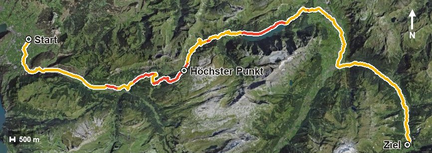
Open interactive map (zoom and pan)
Elevation profile
Route description
The starting point is the centre of Schwyz. Via Ibach and Oberschönenbuch the path follows the Muota into the Muotatal, passes Ried at kilometre 9.3 and reaches Muotathal at kilometre 12.3.
From kilometre 5.7 the main climb stretches over twenty kilometres and gains 986 metres of ascent. The path crosses the Hofbach and the Starzlenbach, passes the Bisistal and reaches the highest point of the route via the Hinter Bärenloch at kilometre 25.8 at 1,550 metres.
On the Glarus side the route descends into the Klöntal, crosses the Chlön, the Schwialpbach and the Richisauerklön and follows the Löntsch through the Löntschtobel. At kilometre 50.6 the Linth is reached.
The final part leads over two further climbs of 287 and 171 metres through the Wartstaldentobel and ends in Glarus Süd at 960 metres. The steepest passage is a mere 16 per cent; the challenge lies in the length.
The route calls for very good fitness and careful planning of accommodation and provisions. Some sections require a sure step and sturdy footwear. It can be walked from May to October.
Grading
Good to know
Getting there / public transport
By public transport to Schwyz; the hike starts in the centre. Current timetable at sbb.ch.
Food and drink
No individual refreshment stops are recorded along the long route. Food, drink and accommodation are available in Schwyz, Muotathal, in the Klöntal and in Glarus.
Best time of year
Recommended: May, Jun, Jul, Aug, Sep, Oct