From Saliboden over the Pfaffenkreuz to the Pragelpass
24.9 kilometres, 1,754 metres of ascent and nine hours of walking: this high-mountain crossing leads from the Saliboden in the Bisistal at 1,137 metres over two passes and a summit to the Pragelpass. One of the longest and most demanding tours in the collection.
The route from above
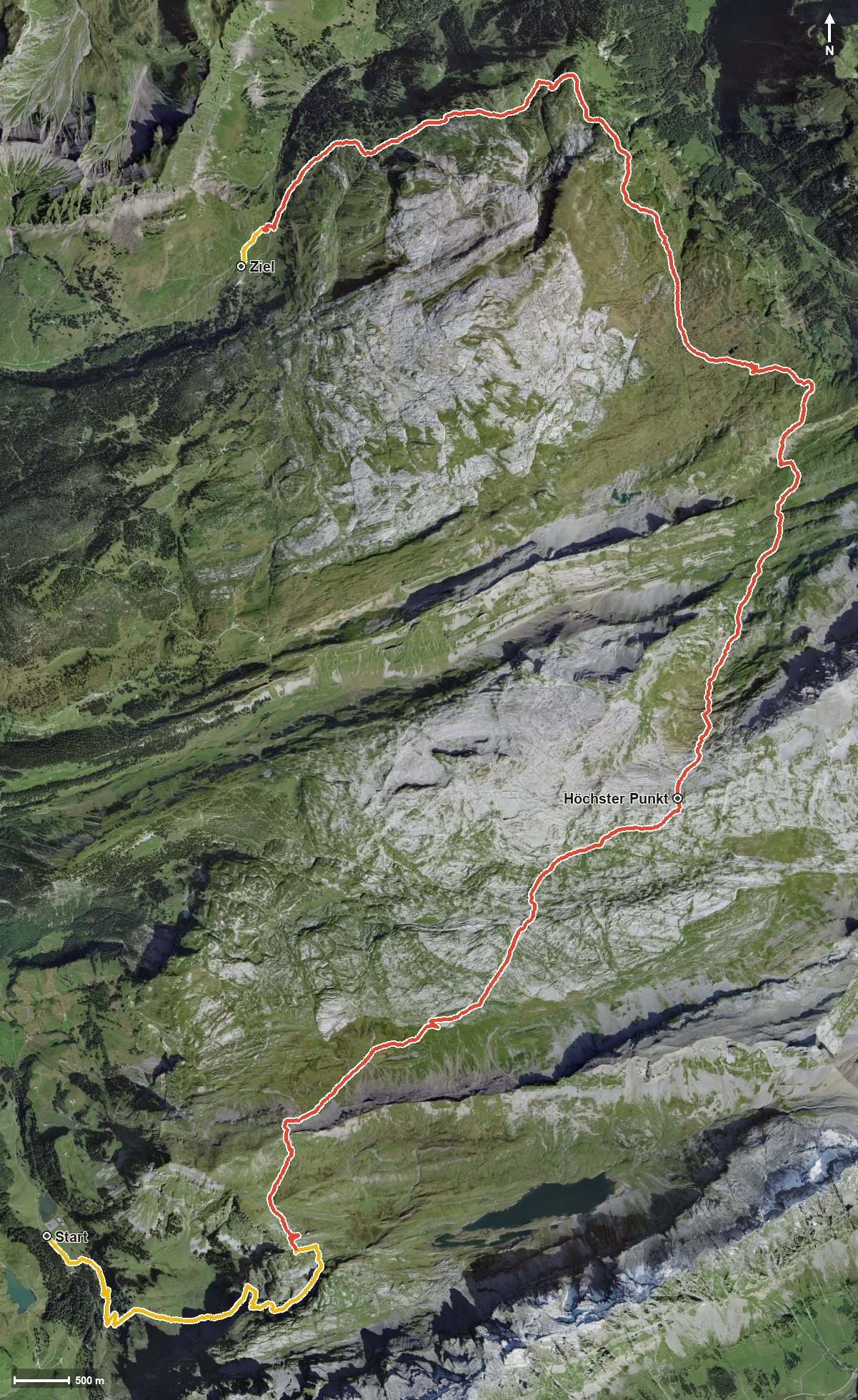
Open interactive map (zoom and pan)
Elevation profile
Route description
The starting point is the Saliboden in the Bisistal. The climb begins at once and gains around 857 metres by kilometre 6.1, where the path crosses the Pfaffenkreuz. The steepest passage lies at kilometre 2.5 and reaches around 30 per cent.
Via the Graben the route continues and gains height again in two pushes of 105 and 199 metres. At kilometre 11.6 the highest point is reached at 2,204 metres, between the Rossmatter Tal and the Klöntal.
At kilometre 13.9 the path passes the Büchel. The long final part leads over the Hinteres Bärenloch and along the Starzlenbach to the Pragelpass at 1,541 metres, with another 121 metres of ascent from kilometre 16.3.
With an elevation range of 1,067 metres and almost 25 kilometres, the tour calls for fitness, a sure step and careful time planning. Because of the altitude it can only be walked from July to October. The Alpwirtschaft Pragelpasshöhe awaits at the finish; no refreshment stop is recorded on the way.
Grading
Good to know
Getting there / public transport
By public transport into the Bisistal. Current timetable at sbb.ch.
Food and drink
Alpwirtschaft Pragelpasshöhe at the finish. No refreshment stop is recorded on the long stretch in between, so take provisions for the whole day.
Best time of year
Recommended: Jul, Aug, Sep, Oct