Loop from Muotathal to the Unter Roggenloch
1,279 metres of ascent on a loop of 18.1 kilometres: this full-day tour starts at Stalden in the Muotatal at 662 metres, climbs in two stages to 1,633 metres and returns to the starting point. Seven hours for one of the longest loops in the region.
The route from above
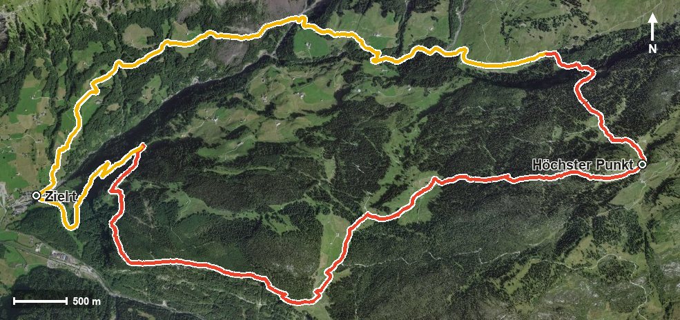
Open interactive map (zoom and pan)
Elevation profile
Route description
The starting point is the stop by the Hölloch in Muotathal, where the path crosses the Starzlenbach straight away. The climb begins at once and gains around 549 metres by kilometre 4.4, passing the Rotenbach and the hamlets of Egg and Haselbach on the way.
Through the Horgrasentobel and the Teufdolen the route continues. From kilometre 4.8 another 406 metres of ascent follow; the steepest passage lies at kilometre 7.1 and reaches around 27 per cent.
Via the Vorder Bärenloch and above the Bisistal the path reaches the Alpwirtschaft Unter Roggenloch at kilometre 8.0, the only refreshment stop recorded. Shortly afterwards, at kilometre 8.7, lies the highest point of the loop at 1,633 metres.
The way back crosses the Gämsstafelbach and leads back to the starting point; the elevation range is 971 metres. Several sections require a sure step and sturdy footwear, and the 18 kilometres call for very good fitness. Because of the altitude the loop can only be walked from June to September.
Grading
Good to know
Getting there / public transport
By public transport to Muotathal, Hölloch. Current timetable at sbb.ch.
Food and drink
Alpwirtschaft Unter Roggenloch at kilometre 8.0, the only refreshment stop recorded on the loop. Provisions for the way belong in the rucksack.
Best time of year
Recommended: Jun, Jul, Aug, Sep