From Obergschwend down to Brunnen
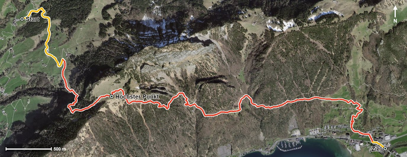
First 327 metres up, then almost a thousand down: this route leads from Obergschwend at 1,019 metres over a short but steep passage and then down to Brunnen on the lakeshore. 7.1 kilometres with a gradient of up to 38 per cent.
The route from above
Open interactive map (zoom and pan)
Elevation profile
Route description
The starting point is Ober Gschwend at 1,019 metres. Via Käppeliberg the climb begins and continues until kilometre 2.5, gaining 327 metres. The steepest passage lies at kilometre 1.5 and reaches around 38 per cent, shortly after crossing the Röhrlisbach.
At kilometre 2.5 the highest point is reached at 1,392 metres. The path then descends through the Chrummtobel and the Sulztal, crosses the Fallenbach at kilometre 4.8 and continues down through the Wigärtlerzug.
At kilometre 5.9 Brunnen is reached; the hike ends after the Muota at 437 metres. There are 956 metres between the highest and lowest points, so the descent makes up the greater part of the tour.
Some sections require a sure step and sturdy footwear. At kilometre 4.6 the Berghaus Bärfallen invites you to a break. The tour is recommended from May to October and crosses the municipal boundary from Gersau into Ingenbohl.
Grading
Good to know
Getting there / public transport
By public transport to the stop «Gersau, Ober Gschwend». Current timetable at sbb.ch.
Food and drink
Berghaus Bärfallen at kilometre 4.6. Further food and drink are available in Brunnen at the finish.
Best time of year
Recommended: May, Jun, Jul, Aug, Sep, Oct