From Brunnen via Gersau to Vitznau
A high-level path above Lake Lucerne: 14.5 kilometres from the Brunnen boat landing at 434 metres to Vitznau. The 531 metres of ascent are spread over two climbs; the highest point lies at 689 metres.
The route from above
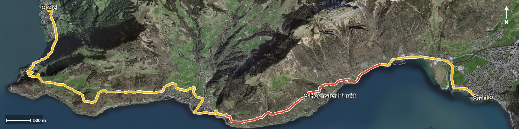
Open interactive map (zoom and pan)
Elevation profile
Route description
The starting point is the Brunnen boat landing. The path crosses the Muota at kilometre 1.0 and leads via the Fallenbach to the Brünischart, where from kilometre 3.4 the first climb of 234 metres begins. The steepest passage is 27 per cent at kilometre 4.4.
Via the Geisstal the route reaches the highest point at kilometre 4.9 at 689 metres. After the Plattenzug and the Totenlauizug it drops down to Gersau, reached at kilometre 6.5.
After crossing the Innerer Dorfbach and the Usserdorfbach, the second climb of 209 metres follows from kilometre 7.5 via the Unter Rengg. At kilometre 11.6 the Gartenrestaurant Kuorez invites you to a break.
Via Oberlinden and Bürglen the path leads down to Vitznau at 438 metres, where it crosses the Mülibach. Some sections require a sure step and sturdy footwear. As both ends are served by the lake boats, the tour combines well with a cruise. It can be walked from May to October.
Grading
Good to know
Getting there / public transport
By public transport or boat to Brunnen; the hike starts at the boat landing. Current timetable at sbb.ch.
Food and drink
Gartenrestaurant Kuorez at kilometre 11.6. Further food and drink are available in Brunnen, in Gersau at kilometre 6.5 and in Vitznau at the finish.
Best time of year
Recommended: May, Jun, Jul, Aug, Sep, Oct