Loop from Gersau via Ausser Urmi
626 metres of ascent in a single push, straight up from the lakeshore: this loop starts at the Gersau boat landing at 434 metres and climbs to 1,070 metres. Ten kilometres, three and a half hours and a season from March to November.
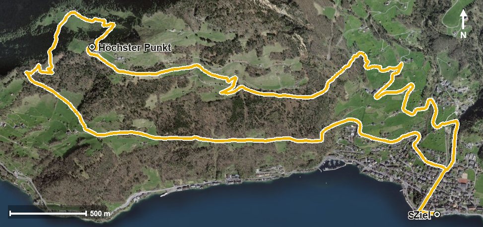
The route from above
Open interactive map (zoom and pan)
Elevation profile
Route description
The starting point is the Gersau boat landing. The path crosses the Innerer Dorfbach at kilometre 0.3 and the Usserdorfbach at kilometre 1.0; the climb begins at once and continues until kilometre 4.9.
Via the Tannenboden the route climbs; the steepest passage is 23 per cent at kilometre 2.7. At kilometre 4.7 Ausser Urmi is reached, and shortly afterwards, at kilometre 4.9, the highest point of the loop at 1,070 metres.
The way back leads down via the Wissifluh, the Lätttobel, the Menschenacher and the Unter Rengg to the lakeshore. The elevation range is 636 metres.
Technically the path remains straightforward, but the continuous climb calls for good basic fitness. No refreshment stop is recorded along the route. The loop crosses the municipal boundary from Gersau into Vitznau and can be walked over a long season from March to November.
Grading
Good to know
Getting there / public transport
By public transport or boat to Gersau; the loop starts at the boat landing. Current timetable at sbb.ch.
Food and drink
There is no place to stop for refreshments along the loop. Food and drink are available in Gersau at the start and finish.
Best time of year
Recommended: Mar, Apr, May, Jun, Jul, Aug, Sep, Oct, Nov