A demanding loop from the Ochsenboden near Studen
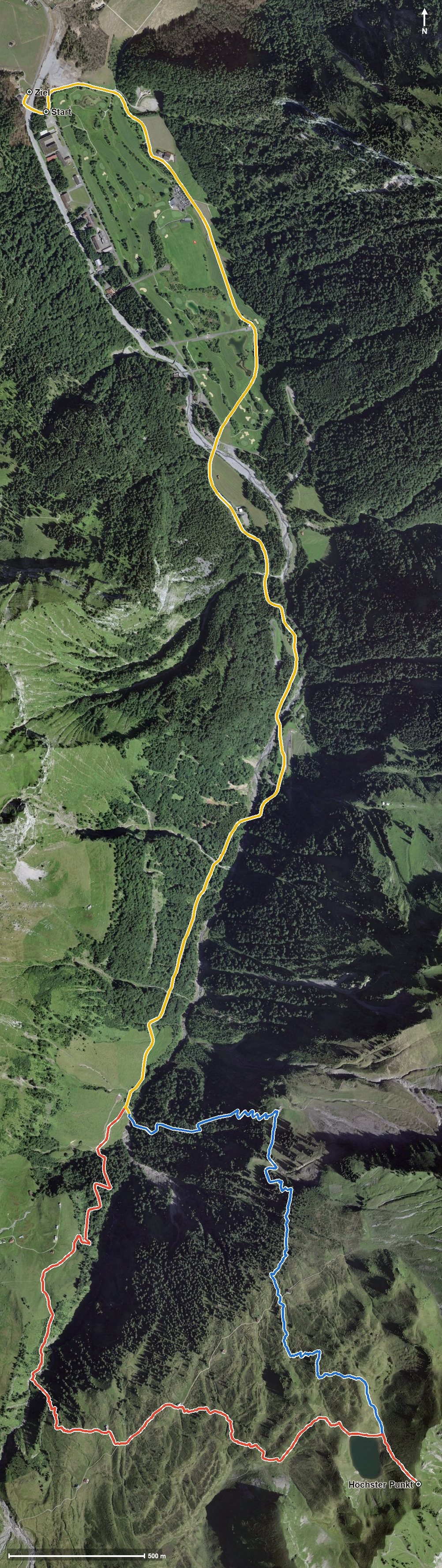
942 metres of ascent in a single push, with a passage at a 42 per cent gradient: this loop starts at the Ochsenboden in Studen at 927 metres and climbs to 1,896 metres. 15.8 kilometres that presuppose alpine experience and a head for heights.
The route from above
Open interactive map (zoom and pan)
Elevation profile
Route description
The starting point is the Ochsenboden near Studen, where the path crosses the Sihl. The climb begins after just 200 metres and continues until kilometre 7.5, without any flat stretch worth mentioning.
The steepest passage lies at kilometre 4.8 and reaches around 42 per cent, one of the highest figures in the whole collection. At kilometre 7.5 the highest point of the loop is reached at 1,896 metres; the elevation range is 975 metres.
On the descent the Lauiberghütte at kilometre 8.8 invites you to a break, the only refreshment stop recorded along the route. Via the Chlims and a ravine the loop closes back at the starting point.
Some sections make considerably higher demands than an ordinary mountain hike. Alpine experience, a sure step, an absolute head for heights and a reliable sense of direction are essential. Because of the altitude the loop can be walked from June to October.
Alpine hiking trail: alpine experience required
This route includes sections of alpine hiking trail. Only for experienced, sure-footed mountain walkers with a head for heights.
Grading
Good to know
Getting there / public transport
By public transport to Studen SZ, Ochsenboden. Current timetable at sbb.ch.
Food and drink
Lauiberghütte at kilometre 8.8, the only refreshment stop recorded on the loop.
Best time of year
Recommended: Jun, Jul, Aug, Sep, Oct