From Studen in the Ybrig to Willerzell on Lake Sihl
12.7 kilometres with a single, but steep, climb: this hike leads from Studen at 892 metres over 1,331 metres across to Willerzell on Lake Sihl. 514 metres of ascent, four hours and a passage with a 34 per cent gradient.
The route from above
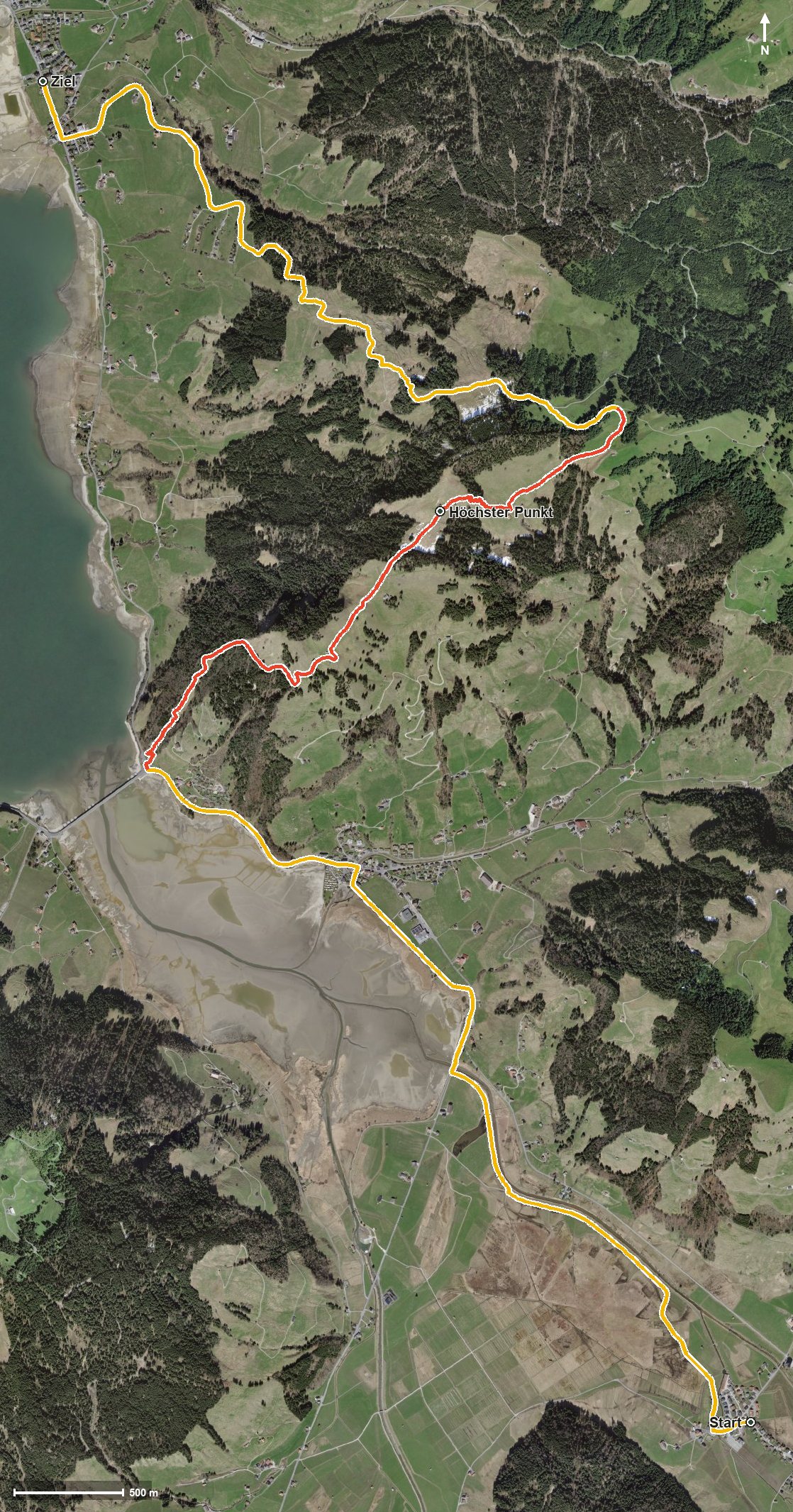
Open interactive map (zoom and pan)
Elevation profile
Route description
The starting point is the Dörfli in Studen. The path crosses the Sihl at kilometre 1.1 and leads via Höhport past the Euthal, crossing the Eubach at kilometre 3.7.
From kilometre 4.6, at the Ruostel, the only climb begins with 432 metres of ascent. The steepest passage lies at kilometre 5.2 and reaches around 34 per cent. At kilometre 7.2 the highest point is reached at 1,331 metres.
The path then descends via the Rickental and crosses the Dimmerbach at kilometre 8.7. Via the Geissweidli the route reaches Willerzell on Lake Sihl at kilometre 11.8; the finish lies at 890 metres.
The elevation range is 444 metres. Some sections require a sure step and sturdy footwear, and the steep climb calls for good basic fitness. No refreshment stop is recorded along the route. The hike crosses the municipal boundary from Unteriberg into Einsiedeln and can be walked from May to October.
Grading
Good to know
Getting there / public transport
By public transport to Studen SZ, Dörfli. Current timetable at sbb.ch.
Food and drink
No refreshment stop is recorded along the route. Food and drink are available in Studen at the start and in Willerzell at the finish.
Best time of year
Recommended: May, Jun, Jul, Aug, Sep, Oct