Loop from Willerzell over the Sattelegg
A big loop above Lake Sihl: 16.4 kilometres from Willerzell at 888 metres, with 750 metres of ascent and a climb to 1,384 metres. The main climb stretches over the first six kilometres and is correspondingly even.
The route from above
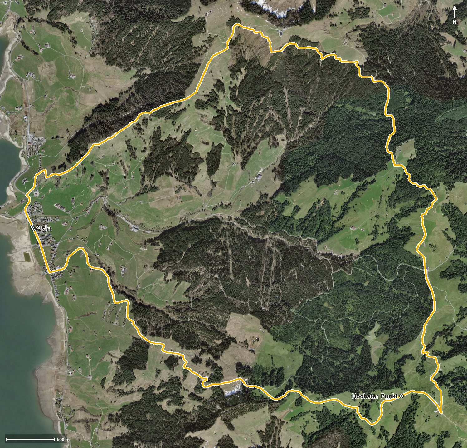
Open interactive map (zoom and pan)
Elevation profile
Route description
The starting point is Willerzell on Lake Sihl. The path crosses the Dimmerbach after 400 metres and then climbs continuously: 478 metres of ascent by kilometre 5.9, on the way via Geissweidli and past the Rickental and the Euthal.
At kilometre 5.9 the highest point is reached at 1,384 metres, high above the Wägital. Via the Chrähwäldli and the Bärichtibach the route continues and passes the Hintere Sattelegg at kilometre 7.6.
Two further climbs of 88 and 83 metres break up the way back, which leads via the Bestgrasbach to Willerzell. The elevation range is 498 metres.
The steepest passage lies at kilometre 3.0 and reaches around 19 per cent; technically the path remains straightforward. No refreshment stop is recorded along the route, so provisions belong in the rucksack. The loop is recommended from April to November and crosses the municipal boundary from Einsiedeln into Vorderthal.
Grading
Good to know
Getting there / public transport
By public transport to the stop «Willerzell, Dimmerbach» on Lake Sihl. Current timetable at sbb.ch.
Food and drink
No refreshment stop is recorded along the route. Take provisions; there are restaurants in Willerzell at the start and finish.
Best time of year
Recommended: Apr, May, Jun, Jul, Aug, Sep, Oct, Nov