From Schindellegi along the Sihl to Neuheim
20.1 kilometres with only 493 metres of ascent: this walk leads from Schindellegi-Feusisberg station at 750 metres along the Sihl all the way to Neuheim at 536 metres. Six hours with an elevation range of 479 metres.
The route from above
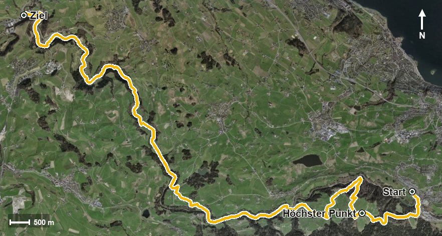
Open interactive map (zoom and pan)
Elevation profile
Route description
The starting point is Schindellegi-Feusisberg station. The climb begins at once and gains around 237 metres by kilometre 2.7; the steepest section is 19 per cent at kilometre 0.6. At kilometre 2.6 the highest point is reached at 1,012 metres.
Via the Unter Rossberg the path descends; from kilometre 4.5 another 71 metres of ascent follow. Via the Sennrüti, the Leinitobel and the Oerischwandtobel the route leads to Oerischwand.
After crossing the Oerischwandbach the path reaches the Sihlau and Heiten at kilometre 6.7 and crosses the Sihl at the Sagi at kilometre 7.2. It then follows the river downstream and crosses the Teufenbach at kilometre 11.2 and the Mülibach at kilometre 15.2.
The walk ends in Neuheim in the canton of Zug. Technically the route remains straightforward, but the 20 kilometres call for endurance. It runs from Feusisberg via Wädenswil to Neuheim and can be walked from April to October.
Grading
Good to know
Getting there / public transport
By public transport to Schindellegi-Feusisberg; the walk starts right at the station. Current timetable at sbb.ch.
Food and drink
No individual refreshment stops are recorded along the route. Food and drink are available in Schindellegi at the start and in Neuheim at the finish.
Best time of year
Recommended: Apr, May, Jun, Jul, Aug, Sep, Oct