From Einsiedeln along the Sihl to Schindellegi
14.7 kilometres with a mere 309 metres of ascent: this valley walk leads from Einsiedeln station at 880 metres down to Schindellegi and Feusisberg. Four hours, a maximum gradient of twelve per cent and a season from April to November.
The route from above
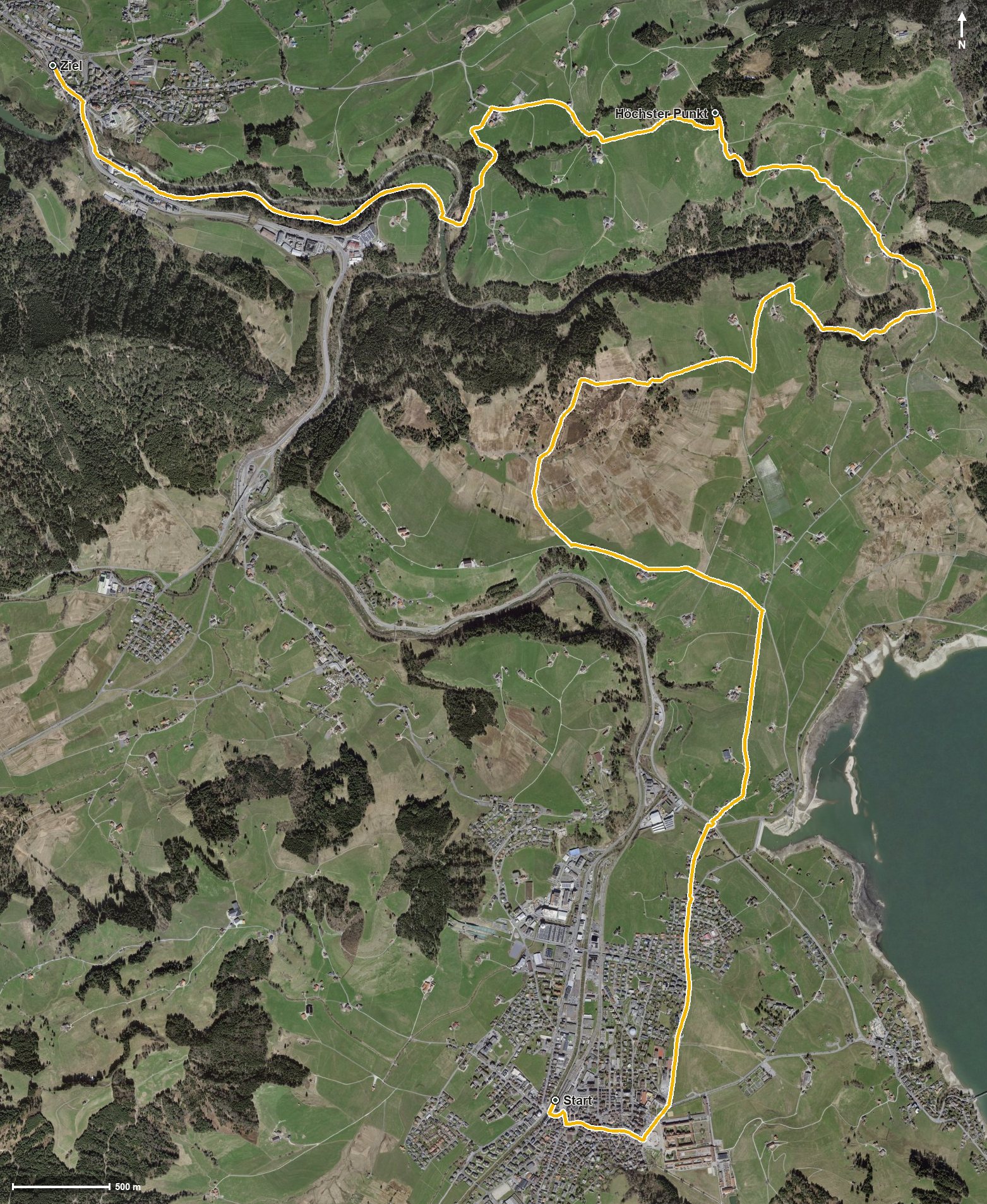
Open interactive map (zoom and pan)
Elevation profile
Route description
The starting point is Einsiedeln station, which makes getting there particularly easy. The path crosses the Alp straight away and shortly afterwards the Wänibach, then follows the valley floor via Hartmannsegg and Hinterhorben.
At kilometre 8.5 the path crosses the Sihl, where the Restaurant Krone invites you to a break. Shortly afterwards the only climb of the route worth mentioning begins with 121 metres of ascent, leading via Bodmern at kilometre 9.8 to the highest point at 973 metres.
Via Büel, the Loch and Wäni the path descends again and reaches Schindellegi at kilometre 13.7. The walk ends in Feusisberg at 750 metres, the lowest point of the route. The elevation range is a mere 223 metres.
Technically the walk makes no particular demands, but the almost 15 kilometres call for a little endurance. Because the route stays on the valley floor, it can be walked over a long season from April to November and suits spring and autumn well.
Grading
Good to know
Getting there / public transport
By public transport to Einsiedeln; the hike starts right at the station. Current timetable at sbb.ch.
Food and drink
Restaurant Krone at kilometre 8.5. Further food and drink are available in Einsiedeln at the start and in Schindellegi at the finish.
Best time of year
Recommended: Apr, May, Jun, Jul, Aug, Sep, Oct, Nov