A small loop from Rigi Scheidegg via Rigi Burggeist
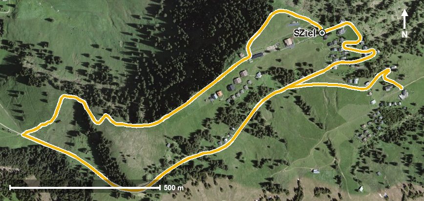
A short loop of four kilometres from Rigi Scheidegg: 146 metres of ascent, an hour of walking and an elevation range of 108 metres. The only climb worth mentioning comes on the last kilometre.
The route from above
Open interactive map (zoom and pan)
Elevation profile
Route description
The starting point is Rigi Scheidegg at 1,646 metres. Right at the beginning, at kilometre 0.1, lies the highest point of the loop at 1,653 metres; the path then drops to 1,545 metres and crosses the Altdorfbach at kilometre 1.5.
At kilometre 2.7 the route passes Rigi Burggeist and leads through the Löcher. From kilometre 2.8 the way back begins with 91 metres of ascent to the starting point.
The steepest section is ten per cent, and technically the hike makes no particular demands. Because of the altitude the loop can be walked from June to October. Food and drink are available at Rigi Scheidegg at the start and finish.
Grading
Good to know
Getting there / public transport
By public transport to Goldau, then the cable car from Kräbel up to Rigi Scheidegg. Current timetable at sbb.ch.
Food and drink
No refreshment stop is recorded along the loop. Food and drink are available at Rigi Scheidegg at the start and finish.
Best time of year
Recommended: Jun, Jul, Aug, Sep, Oct