A level loop from Ried near Muotathal
3.8 kilometres with a mere 20 metres of ascent: this loop from Ried near Muotathal at 571 metres has an elevation range of just 17 metres, making it the flattest route in the collection. One hour without any climb at all.
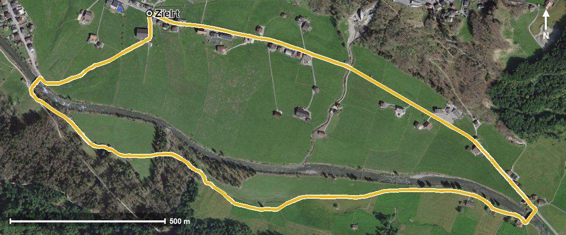
The route from above
Open interactive map (zoom and pan)
Elevation profile
Route description
The starting point is Ried near Muotathal at the Kappelmatt. The path stays on the valley floor throughout and crosses the Muota at kilometre 1.5.
At kilometre 0.7 the highest point of the loop is already reached at 584 metres; the lowest lies at 567 metres. The steepest section is two per cent.
Via the Gütsch at kilometre 2.5 and after crossing the Tröliger Bach, the route leads via Mühlestuden back to the starting point.
Technically the walk makes no demands and suits all ages, including with a pushchair. It can be walked from May to October. No refreshment stop is recorded along the route, but food and drink are available in Muotathal.
Grading
Good to know
Getting there / public transport
By public transport into the Muotatal to Ried, Kappelmatt. Current timetable at sbb.ch.
Food and drink
No refreshment stop is recorded along the route. Food and drink are available in Muotathal.
Best time of year
Recommended: May, Jun, Jul, Aug, Sep, Oct