Hike from Riedberg to Riemenstalden
13.3 kilometres, 1,417 metres of ascent and around 6½ h on the move: a route from Riedberg to Riemenstalden in the Riemenstalden valley. Only for mountain walkers with alpine experience, a sure step and an absolute head for heights.
The route from above
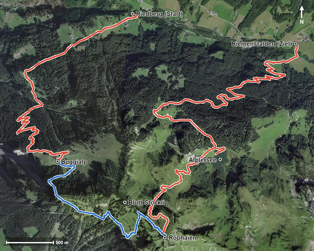
Open interactive map (zoom and pan)
Elevation profile
Route description
The tour begins at Riedberg at 811 metres. On the way the route passes the Riemenstalden valley, the Buggital, the Lauwital and the Teiftal and reaches the highest point at kilometre 6.7 on the Rophaien at 2,078 metres. The finish is Riemenstalden at 1,004 metres.
The path gains its height in two sections; the longest climb is 749 metres between kilometres 0.0 and 4.8. The steepest passage lies at kilometre 6.2 and reaches around 44 per cent.
Some sections make considerably higher demands than an ordinary mountain hike. Alpine experience, a sure step, an absolute head for heights and a reliable sense of direction are essential. The tour is recommended from June to October. It crosses the municipal boundary between Riemenstalden and Sisikon.
Alpine hiking trail: alpine experience required
Parts of the route make considerably higher demands than an ordinary mountain hike: pathless or exposed passages that presuppose alpine experience, a sure step, an absolute head for heights and a reliable sense of direction.
Grading
Good to know
Getting there / public transport
By public transport to the stop «Riemenstalden, Riedberg». Current timetable at sbb.ch. to be checked
Food and drink
No refreshment stop is recorded along the route. Take provisions for the way; there are restaurants at the Riedberg stop, in Riemenstalden and the surrounding area. to be checked
Best time of year
Recommended: Jun, Jul, Aug, Sep, Oct to be checked