Summit loop over the Chaiserstock, Fulen and Rossstock
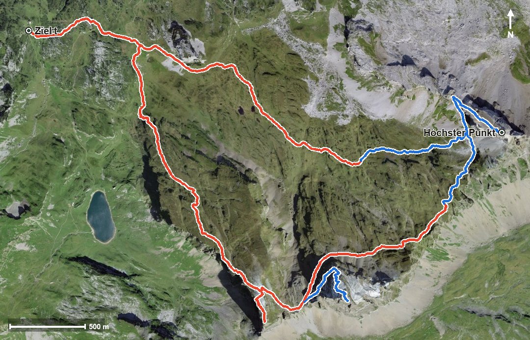
Three summits above 2,400 metres in one day: this loop from the Chäppeliberg–Gitschen top station at 1,716 metres leads over the Chaiserstock, the Fulen and the Rossstock. 1,345 metres of ascent, six and a half hours and one passage at a 42 per cent gradient. Only for mountaineers with alpine experience.
The route from above
Open interactive map (zoom and pan)
Elevation profile
Route description
The starting point is the top station of the Chäppeliberg–Gitschen cable car. After just 600 metres the path passes the Lidernenhütte SAC, after which the main climb of 773 metres begins and lasts until kilometre 4.5.
The steepest passage lies at kilometre 3.9 and reaches around 42 per cent. At kilometre 4.5 the Chaiserstock is reached at 2,514 metres, the highest point of the loop, high above the Riemenstalden valley and the Hürital.
From kilometre 6.0 the second climb of 258 metres follows to the Fulen at kilometre 7.9, then another 127 metres to the Rossstock at kilometre 9.3. The way back leads via the Löcher to the starting point.
Some sections make considerably higher demands than an ordinary mountain hike. Alpine experience, a sure step, an absolute head for heights and a reliable sense of direction are essential. Because of the altitude the loop can be walked from June to October.
Alpine hiking trail: alpine experience required
This route includes sections of alpine hiking trail. Only for experienced, sure-footed mountain walkers with a head for heights.
Grading
Good to know
Getting there / public transport
By public transport into the Riemenstalden valley and on by the Chäppeliberg–Spilau cable car. Current timetable at sbb.ch.
Food and drink
Lidernenhütte SAC at kilometre 0.6. No refreshment stop is recorded on the rest of the loop, so take provisions for the whole day.
Best time of year
Recommended: Jun, Jul, Aug, Sep, Oct