From the Seebodenalp down to Oberarth
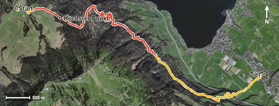
620 metres of descent in 8.2 kilometres, without any counter-climb worth mentioning: this route leads from the Seebodenalp at 1,018 metres down to Oberarth. With a maximum gradient of eight per cent the descent is spread evenly.
The route from above
Open interactive map (zoom and pan)
Elevation profile
Route description
The starting point is the Seebodenalp, where the path crosses the Dorfbach and the Ghürschbach straight away. Via Alpetli at kilometre 0.6 the route reaches the highest point at kilometre 1.2 at 1,055 metres, after which it is downhill all the way.
The path crosses the Witeschrandbach at kilometre 4.4 and the Trehbach at kilometre 5.7 and leads via Engelrüti to Oberarth, reached at kilometre 7.7. The hike ends at 445 metres; the elevation range is 610 metres.
Some sections call for a sure step; sturdy footwear is part of the kit. Walking poles are a sensible aid on a descent like this. The tour is recommended from May to October and crosses the municipal boundary from Küssnacht am Rigi into Arth.
Grading
Good to know
Getting there / public transport
By public transport to Küssnacht am Rigi, then the cable car up to Seebodenalp. Current timetable at sbb.ch.
Food and drink
No refreshment stop is recorded along the route. Food and drink are available at the Seebodenalp at the start and in Oberarth at the finish.
Best time of year
Recommended: May, Jun, Jul, Aug, Sep, Oct