A short climb from Illgau to the Guggenhürli
1.1 kilometres and 112 metres of ascent: this very short climb leads from Illgau at 804 metres up to the Guggenhürli at 917 metres. Half an hour that heads properly uphill from the word go.
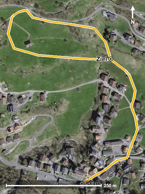
The route from above
Open interactive map (zoom and pan)
Elevation profile
Route description
The starting point is Illgau, where the path crosses the Bettbach straight away. The climb begins at once and gains 104 metres over the first 800 metres.
The steepest section is 18 per cent at kilometre 0.3. At kilometre 0.7 the Guggenhürli is reached, and at kilometre 0.8 lies the highest point at 917 metres.
The walk ends at 849 metres; the elevation range is 113 metres. Despite the short distance the path is noticeably steep.
Technically it makes no particular demands; sturdy footwear is enough. The route can be walked from May to October. Given its short distance, it combines well with one of the longer tours from Illgau. Food and drink are available in Illgau.
Grading
Good to know
Getting there / public transport
By public transport to Illgau, also reachable by cable car from Ried in the Muotatal. Current timetable at sbb.ch.
Food and drink
No refreshment stop is recorded along the route. Food and drink are available in Illgau.
Best time of year
Recommended: May, Jun, Jul, Aug, Sep, Oct