Loop from the Ibergeregg around the Laucherenstöckli
A loop with an even profile: 11.3 kilometres from the Ibergeregg pass at 1,403 metres, with 561 metres of ascent spread over three short climbs. The elevation range is just 314 metres, which makes the tour easy to break up.
The route from above
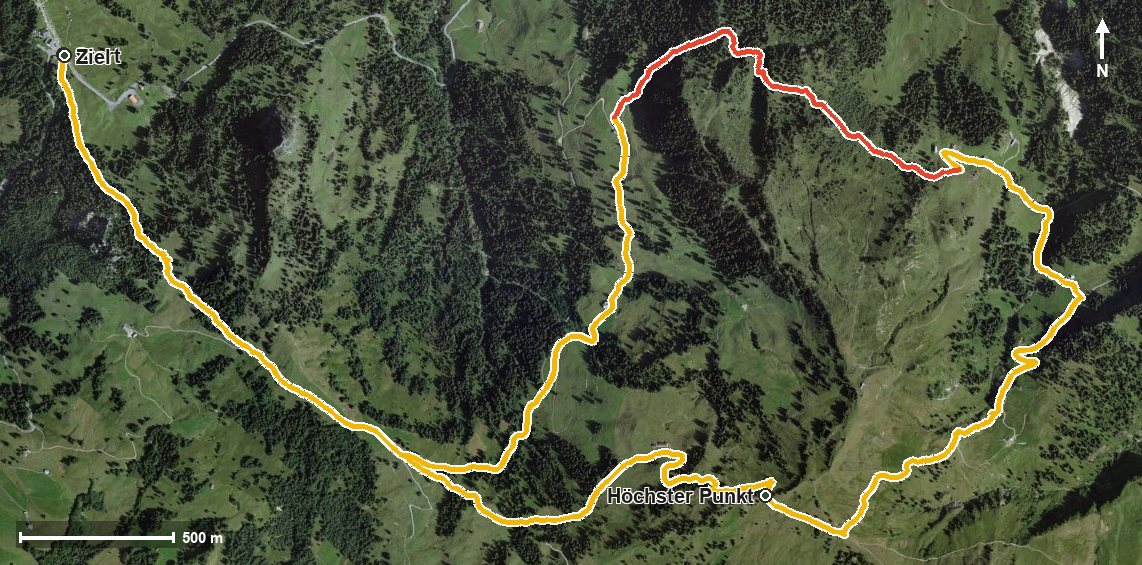
Open interactive map (zoom and pan)
Elevation profile
Route description
The starting point is the Ibergeregg pass, where the Restaurant Passhöhe stands right at the start. The path leads through the Schijenloch and gains 97 metres over the first kilometre; the steepest section is 17 per cent at kilometre 0.4.
Via the Isentobel the route reaches the Sternenegg saddle at kilometre 1.8. From kilometre 1.9 the main climb of 211 metres follows; on the way the path crosses the Minster at kilometre 2.5. At kilometre 3.6 the highest point is reached at 1,716 metres.
The path then descends via the Richtitobel, the Chöpfentobel and the Laucherentobel. At kilometre 6.1 the Restaurant Laucheren invites you to a break; from kilometre 5.7 the route gains another 81 metres.
Via the Chäswaldtobel and the Isentobelhütte at kilometre 8.3 the loop closes back at the Ibergeregg. Some sections require a sure step and sturdy footwear. The route crosses the municipal boundary from Schwyz into Oberiberg and can be walked from May to October.
Grading
Good to know
Getting there / public transport
By public transport to the Ibergeregg pass. Current timetable at sbb.ch.
Food and drink
Restaurant Passhöhe Ibergeregg at the start and finish, Restaurant Laucheren at kilometre 6.1 and Isentobelhütte at kilometre 8.3.
Best time of year
Recommended: May, Jun, Jul, Aug, Sep, Oct