A hike on the Mostelberg
One long, even climb up to the Mostelberg and back down the other side: the loop from Sattel spreads its 400-odd metres of ascent over 6.5 kilometres and remains technically undemanding. A manageable half-day tour that needs no mountain experience.
The route from above
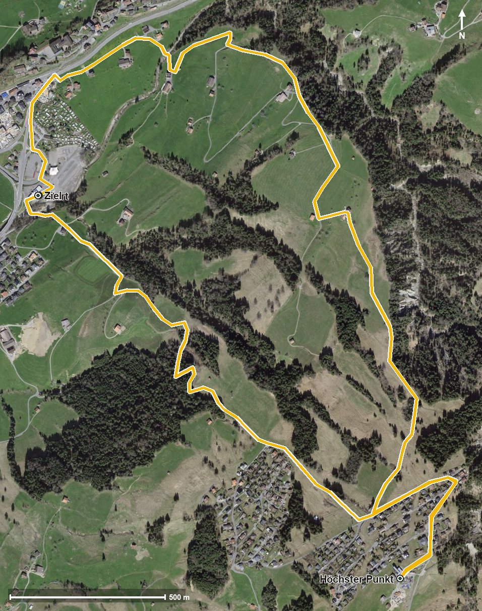
Open interactive map (zoom and pan)
Elevation profile
Route description
It starts at the Sattel-Mostelberg valley station at 775 metres. The path leads out of the village, crosses the Lauitobelbach after a good kilometre and then climbs steadily via Jansern and the Laumattloch. After around three kilometres the Mostelberg is reached; the highest point of the loop lies at kilometre 3.9 at 1,182 metres. Via Egg the path then leads back to the starting point.
What is characteristic is that the 407 metres of ascent fall within a single long climb: from kilometre 0 to 3.9 it is almost continuously uphill, after that only downhill. The steepest passage lies at kilometre 2.2 with a gradient of around 21 per cent, demanding but nowhere exposed.
Neither a particularly sure step nor a head for heights is needed on this loop. The Berggasthaus Mostelberg stands at the highest point. If you want to shorten the climb, the Sattel–Mostelberg gondola links the valley station directly with the Mostelberg. The tour is recommended from May to October.
Grading
Good to know
Getting there / public transport
By public transport to Sattel, stops «Sattel, Gondelbahn» or «Sattel, Talstation» right at the starting point. Current timetable at sbb.ch.
Food and drink
Berggasthaus Mostelberg at the highest point of the loop (kilometre 3.9). Further food and drink in the village of Sattel at the start.
Best time of year
Recommended: May, Jun, Jul, Aug, Sep, Oct