From Sattel to Morgarten on Lake Ägeri
Five kilometres across historic ground: this walk leads from the parish church in Sattel at 824 metres across to Morgarten on Lake Ägeri. 162 metres of ascent, an hour and a half and an elevation range of just 159 metres.
The route from above
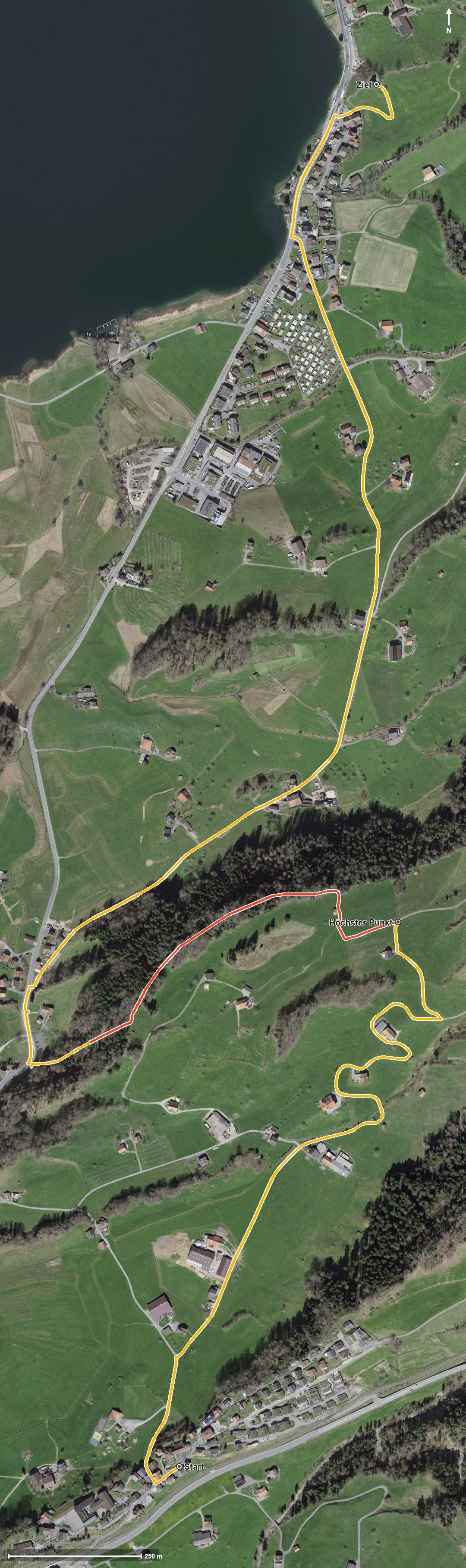
Open interactive map (zoom and pan)
Elevation profile
Route description
The starting point is the parish church in Sattel. From kilometre 0.5 a gentle climb of 93 metres begins; the steepest section is eleven per cent at kilometre 1.1.
At kilometre 1.7 the highest point is reached at 884 metres. Via Figlen the path descends and reaches Morgarten at kilometre 3.3, where the famous battle took place in 1315.
At kilometre 4.5 stands the Morgarten Hotel on Lake Ägeri, the refreshment stop recorded along the route. The walk ends in Oberägeri at 749 metres; the lowest point lies at 725 metres.
Some sections require a sure step and sturdy footwear, but technically the path remains manageable. The short distance makes the tour interesting for families with children too. It crosses the cantonal border from Sattel into Oberägeri and can be walked from April to October.
Grading
Good to know
Getting there / public transport
By public transport to Sattel; the walk starts at the parish church. Current timetable at sbb.ch.
Food and drink
Morgarten Hotel at kilometre 4.5 on Lake Ägeri. Further food and drink are available in Sattel at the start.
Best time of year
Recommended: Apr, May, Jun, Jul, Aug, Sep, Oct