A short, steep loop from the Urmiberg top station
296 metres of ascent in only 3.3 kilometres: this compact loop starts at the Urmiberg top station at 1,136 metres and climbs to 1,395 metres. An hour and a half that you feel despite the short distance.
The route from above
Open interactive map (zoom and pan)
Elevation profile
Route description
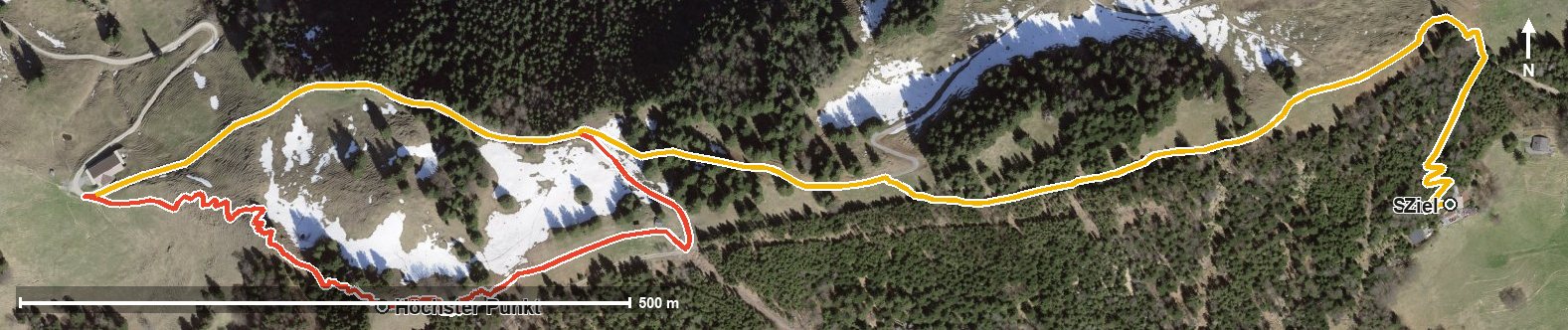
The starting point is the top station of the Brunnen–Urmiberg cable car at the Timpel, where the Bergrestaurant Timpelweid stands right at the start. The steepest passage comes right at the beginning and reaches around 22 per cent.
The climb gains around 251 metres by kilometre 1.5 and leads across the Teuftobel. At kilometre 1.5 the highest point of the loop is reached at 1,395 metres.
The way back descends through the valley to the top station. The elevation range is 259 metres.
Several sections require a sure step and sturdy footwear. Given its short distance, the loop makes a good side trip after the ride up or an addition to a longer tour. It can be walked from May to September.
Grading
Good to know
Getting there / public transport
By public transport to Brunnen and on by cable car up the Urmiberg. Current timetable at sbb.ch.
Food and drink
Bergrestaurant Timpelweid at the start and finish, the only refreshment stop recorded.
Best time of year
Recommended: May, Jun, Jul, Aug, Sep