A short forest loop from St. Anna in Steinerberg
2.6 kilometres with 135 metres of ascent: this short loop from St. Anna in Steinerberg at 625 metres climbs to 756 metres. One hour with an elevation range of 131 metres.
The route from above
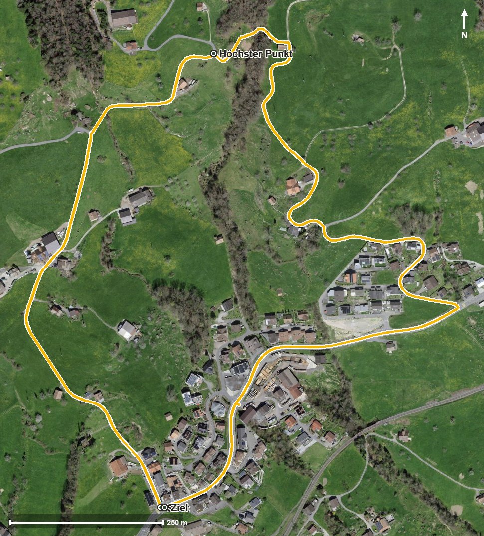
Open interactive map (zoom and pan)
Elevation profile
Route description
The starting point is St. Anna in Steinerberg. The climb begins at once and gains 125 metres over the first kilometre; the steepest section is 14 per cent at kilometre 0.2.
At kilometre 1.0 the highest point of the loop is reached at 756 metres. The path then descends via the Töbeli and crosses the Mulfisbach at kilometre 1.1.
The lowest point lies at the start and finish at 625 metres. Despite the short distance, the climb is noticeable.
Technically the hike makes no particular demands and is therefore suitable for families with children too. It can be walked from April to October. No refreshment stop is recorded along the route, but food and drink are available in Steinerberg.
Grading
Good to know
Getting there / public transport
By public transport to Steinerberg; the loop starts at St. Anna. Current timetable at sbb.ch.
Food and drink
No refreshment stop is recorded along the loop. Food and drink are available in Steinerberg.
Best time of year
Recommended: Apr, May, Jun, Jul, Aug, Sep, Oct