Loop from Steinen station via Steinerberg
Six kilometres with 190 metres of ascent: this loop from Steinen station at 466 metres leads via Steinerberg and has an elevation range of just 146 metres. Two hours with a maximum gradient of 13 per cent.
The route from above
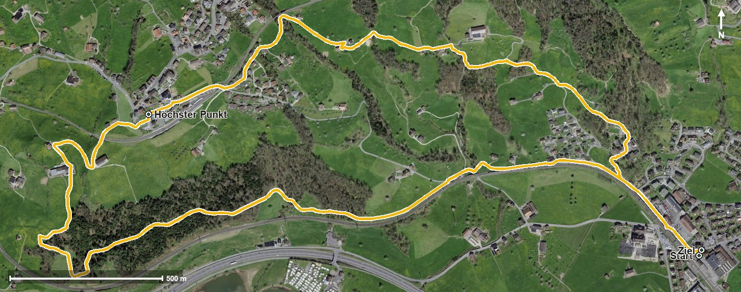
Open interactive map (zoom and pan)
Elevation profile
Route description
The starting point is Steinen station, which makes getting there particularly easy. The path crosses the Chäppelibach at kilometre 0.3 and reaches the Buchenhof at kilometre 1.5.
At kilometre 3.0 Steinerberg is reached. From kilometre 2.4 the path gains 102 metres; the steepest section is 13 per cent at kilometre 2.6. At kilometre 3.5 lies the highest point of the loop at 607 metres.
Via Schwandli and Gupfenried the path descends back to Steinen, crossing the Mulfisbach and the Widenbach on the way. The lowest point lies at 461 metres.
Technically the walk makes no demands and is therefore suitable for all ages. Because it stays low, it can be walked over a long season from March to November. It crosses the municipal boundary from Steinen into Steinerberg.
Grading
Good to know
Getting there / public transport
By public transport to Steinen; the loop starts right at the station. Current timetable at sbb.ch.
Food and drink
No refreshment stop is recorded along the route. Food and drink are available in Steinen at the start and finish and in Steinerberg at kilometre 3.0.
Best time of year
Recommended: Mar, Apr, May, Jun, Jul, Aug, Sep, Oct, Nov