A short high-level loop from the Gersau boat landing
A manageable loop above Lake Lucerne: 7.8 kilometres from the Gersau boat landing at 435 metres, with 321 metres of ascent and an elevation range of 222 metres. Two and a half hours and a season that runs from March to November.
The route from above
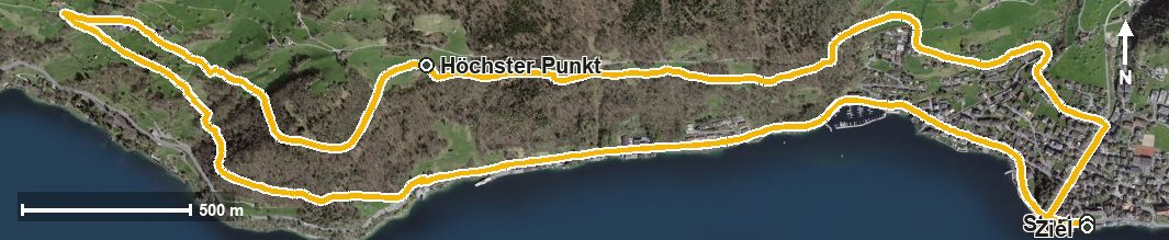
Open interactive map (zoom and pan)
Elevation profile
Route description
The starting point is the Gersau boat landing. The path crosses the Innerer Dorfbach at kilometre 0.3 and the Usserdorfbach at kilometre 0.8 and climbs 117 metres over the first 1.6 kilometres.
After a short stretch in between, a second climb of 103 metres follows via the Unter Rengg. At kilometre 2.9 the highest point of the loop is reached at 656 metres; the steepest section is 15 per cent at kilometre 1.8.
At kilometre 4.1 the Gartenrestaurant Kuorez invites you to a break. Via Oberlinden, Furt, Forst, Förstli and the Berchtrüti the path descends back to the lakeshore.
Technically the hike makes no particular demands and is therefore suitable for families too. Because it stays low, it can be walked over a long season from March to November. Arriving by boat makes the outing especially attractive.
Grading
Good to know
Getting there / public transport
By public transport or boat to Gersau; the loop starts at the boat landing. Current timetable at sbb.ch.
Food and drink
Gartenrestaurant Kuorez at kilometre 4.1. Further food and drink are available in Gersau at the start and finish.
Best time of year
Recommended: Mar, Apr, May, Jun, Jul, Aug, Sep, Oct, Nov