Loop from Oberiberg over the Fuederegg
11.6 kilometres with 668 metres of ascent: this loop from Oberiberg at 1,087 metres climbs to 1,683 metres and returns over the Fuederegg. Four hours with three refreshment stops on the way.
The route from above
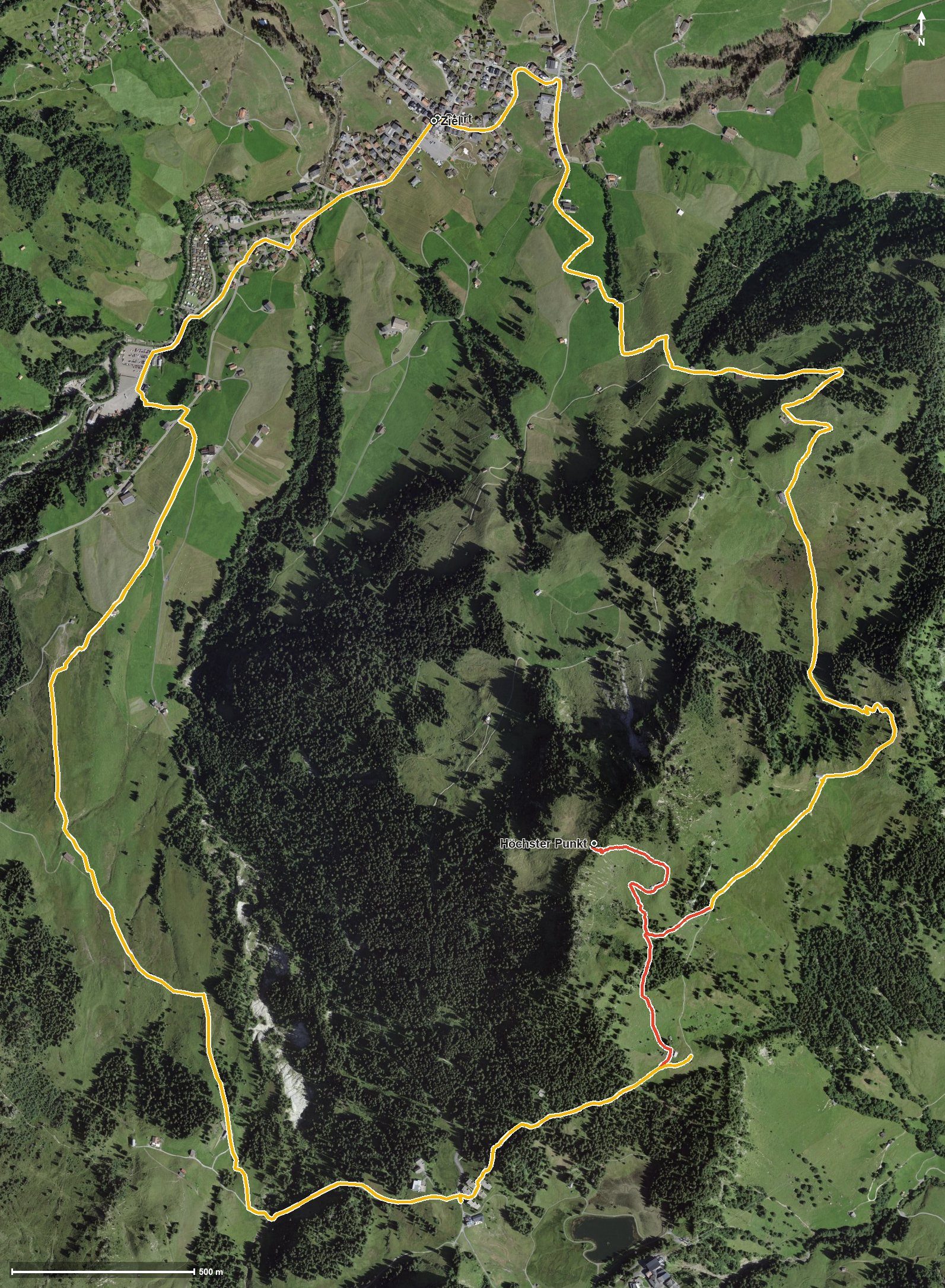
Open interactive map (zoom and pan)
Elevation profile
Route description
The starting point is Oberiberg. The climb begins at once and gains around 471 metres by kilometre 3.9; on the way the path leads through the Leetobel and crosses the Tubenmoosbach at kilometre 1.8. The steepest passage is 21 per cent at kilometre 1.1.
After the Loch, a second climb of 131 metres follows from kilometre 4.3. At kilometre 5.1 the highest point of the loop is reached at 1,683 metres.
At kilometre 5.9 the Roggenhütte invites you to a break, and at kilometre 6.9 the Fuederegg with the Restaurant Fuederegg. Via the Guggerenloch, the Chäswaldtobel and the Laucherentobel the path descends, and at kilometre 9.6 the Restaurant Buoffenalp follows.
Via Tschalun and after crossing the Minster and the Sagentobel, the loop closes back at the starting point. The elevation range is 615 metres. Some sections require a sure step and sturdy footwear. The loop can be walked from May to October.
Grading
Good to know
Getting there / public transport
By public transport to Oberiberg. Current timetable at sbb.ch.
Food and drink
Roggenhütte at kilometre 5.9, Restaurant Fuederegg at kilometre 6.9 and Restaurant Buoffenalp at kilometre 9.6.
Best time of year
Recommended: May, Jun, Jul, Aug, Sep, Oct