From Pfäffikon over the Etzel to Feusisberg
675 metres of ascent in a single climb, from Lake Zurich up to the Etzel: this route leads from Pfäffikon station at 411 metres up to 1,097 metres and then down to Feusisberg. 10.8 kilometres with one passage at a 41 per cent gradient.
The route from above
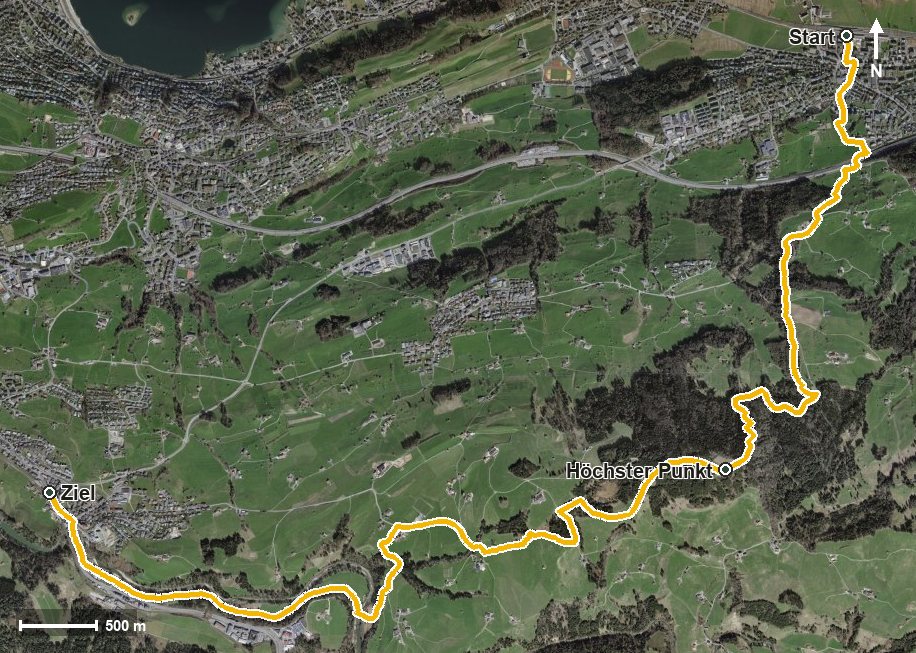
Open interactive map (zoom and pan)
Elevation profile
Route description
The starting point is Pfäffikon station, which makes getting there particularly easy. After crossing the Staldenbach the climb begins and continues until kilometre 4.4, with 675 metres of ascent to overcome.
The steepest passage comes shortly before the top of the climb, at kilometre 3.8, and reaches around 41 per cent. At kilometre 4.5 the Etzel is reached, where the Bergrestaurant Etzel Kulm invites you to a break.
The second part leads down via Büel, the Loch and Wäni, crosses the Sihl at kilometre 8.3 and reaches Schindellegi at kilometre 9.8. The hike ends in Feusisberg at 750 metres; the elevation range is 686 metres.
Technically the path remains straightforward, but the steep climb calls for good basic fitness. The tour is recommended from April to October and crosses the municipal boundary from Freienbach into Feusisberg.
Grading
Good to know
Getting there / public transport
By public transport to Pfäffikon SZ; the hike starts at the station. Current timetable at sbb.ch.
Food and drink
Bergrestaurant Etzel Kulm at kilometre 4.5, right at the highest point of the tour.
Best time of year
Recommended: Apr, May, Jun, Jul, Aug, Sep, Oct