From the Holzegg over the Ibergeregg to Illgau
A long high-level hike that descends more than it climbs: from the Holzegg at 1,395 metres, 16.5 kilometres lead over two passes down to Illgau at 818 metres. With only 768 metres of ascent against 1,346 metres of descent, the tour is above all a question of endurance.
The route from above
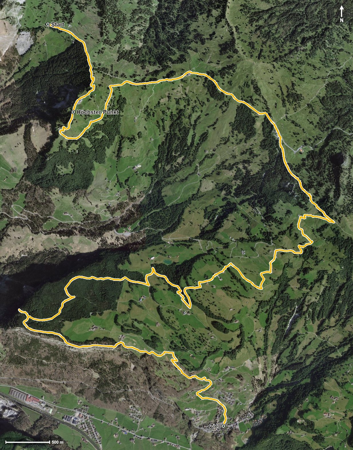
Open interactive map (zoom and pan)
Elevation profile
Route description
It starts at the Holzegg at the foot of the Mythen. After just 700 metres the path crosses the Stäglerenegg, and shortly afterwards, at kilometre 1.5, the highest point of the tour is reached at 1,552 metres. At kilometre 1.8 the route passes the Rotenfluh.
The middle section leads over the Ibergeregg at kilometre 5.2, where another 98 metres of ascent await. It then descends through the Schijenloch, past the Chlingentobelbach and the Hasentobelbach, via Oberberg at kilometre 9.2.
The final section leads through the Chlingentobel and via Wartberg and Wart to Illgau, reached at kilometre 15.8. The steepest section, at around 23 per cent, comes surprisingly late at kilometre 13.7, in the middle of the descent. Technically the path remains straightforward, but the length calls for realistic time planning.
No fewer than four inns invite you to stop: the Berggasthaus Holzegg and the Skihaus Holzegg at the start, the Berggasthaus Rothenfluh at kilometre 1.8 and the Restaurant Passhöhe Ibergeregg at kilometre 5.2. The tour is recommended from May to October.
Grading
Good to know
Getting there / public transport
By public transport into the Alptal to Brunni and on by cable car to the Holzegg. Current timetable at sbb.ch.
Food and drink
Berggasthaus Holzegg and Skihaus Holzegg at the start, Berggasthaus Rothenfluh at kilometre 1.8 and Restaurant Passhöhe Ibergeregg at kilometre 5.2.
Best time of year
Recommended: May, Jun, Jul, Aug, Sep, Oct