From Illgau over the Wartberg to the Oberberg
9.7 kilometres with 600 metres of ascent spread over four short climbs: this hike leads from Illgau at 805 metres up to 1,255 metres. Three hours on the sunny side above the Muotatal.
The route from above
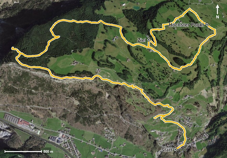
Open interactive map (zoom and pan)
Elevation profile
Route description
The starting point is the village of Illgau, where the path crosses the Bettbach straight away. The steepest passage comes as early as kilometre 0.3 at around 19 per cent; the first climb gains 119 metres.
Via Guggenhürli, Wart and Wartberg the route climbs in two further stages of 135 and 132 metres and passes the Chlingentobel at kilometre 3.8.
After a longer intermediate stretch, the last climb of 63 metres follows from kilometre 6.5 via Steinweid and Oberberg. At kilometre 8.1 the highest point is reached at 1,255 metres.
Via Ober Hasen and Unter Zimmerstalden the hike ends at 1,164 metres. The elevation range is 450 metres. Technically the path is straightforward, and the four climbs make it easy to break up. No refreshment stop is recorded along the route. It can be walked from June to September.
Grading
Good to know
Getting there / public transport
By public transport to Illgau, also reachable by cable car from Ried in the Muotatal. Current timetable at sbb.ch.
Food and drink
No refreshment stop is recorded along the route. Food and drink are available in Illgau at the start.
Best time of year
Recommended: Jun, Jul, Aug, Sep