From Küssnacht am Rigi to Lucerne
17.2 kilometres, a good four and a half hours and a mere 324 metres of ascent: this stage leads from Küssnacht am Rigi along the lakeshore all the way to Lucerne. With a maximum gradient of twelve per cent it is one of the easiest longer routes in the collection.
The route from above
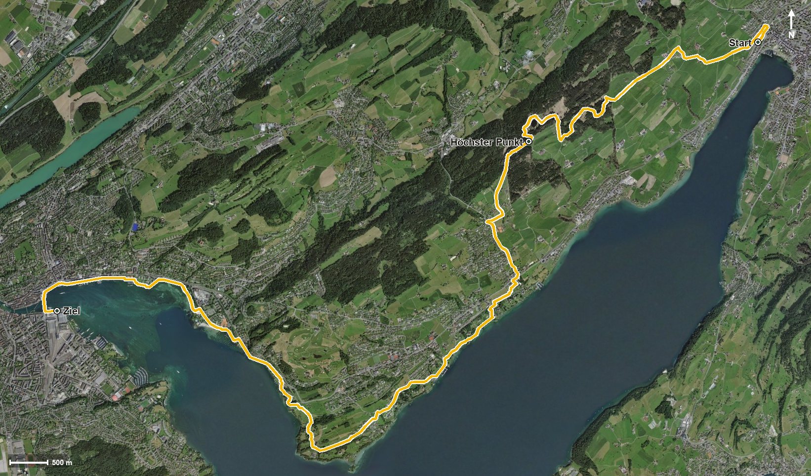
Open interactive map (zoom and pan)
Elevation profile
Route description
The starting point is Küssnacht am Rigi station at 456 metres. The path first climbs in two short sections of 94 and 69 metres, passing over the Allmig.
The middle section runs through the Mülital and reaches Meggen at kilometre 6.6. Via Florina and the Oberseeburg the route approaches the edge of the city and reaches Lucerne at kilometre 12.2, where it continues along the right-hand shore of the lake.
The steepest section comes right at the beginning, at kilometre 0.7, and reaches twelve per cent; after that the profile stays even. Technically the walk makes no particular demands; neither a sure step nor a head for heights is needed.
At kilometre 13.5 the Hotel Seeburg invites you to a break. The stage is part of the Waldstätterweg, the regional walking route around Lake Lucerne, and passes through the municipalities of Küssnacht am Rigi, Meggen and Lucerne. It is recommended from May to October.
Grading
Good to know
Getting there / public transport
By public transport to Küssnacht am Rigi; the walk starts at the station. Current timetable at sbb.ch.
Food and drink
Hotel Seeburg at kilometre 13.5. Further food and drink are available in the places the route passes through: Küssnacht, Meggen and Lucerne.
Best time of year
Recommended: May, Jun, Jul, Aug, Sep, Oct