A short loop from Gersau over the Sellenweid
5.1 kilometres with 363 metres of ascent: this compact loop starts in Gersau at 433 metres, right on Lake Lucerne, and climbs to 685 metres. Two hours with an elevation range of 252 metres.
The route from above
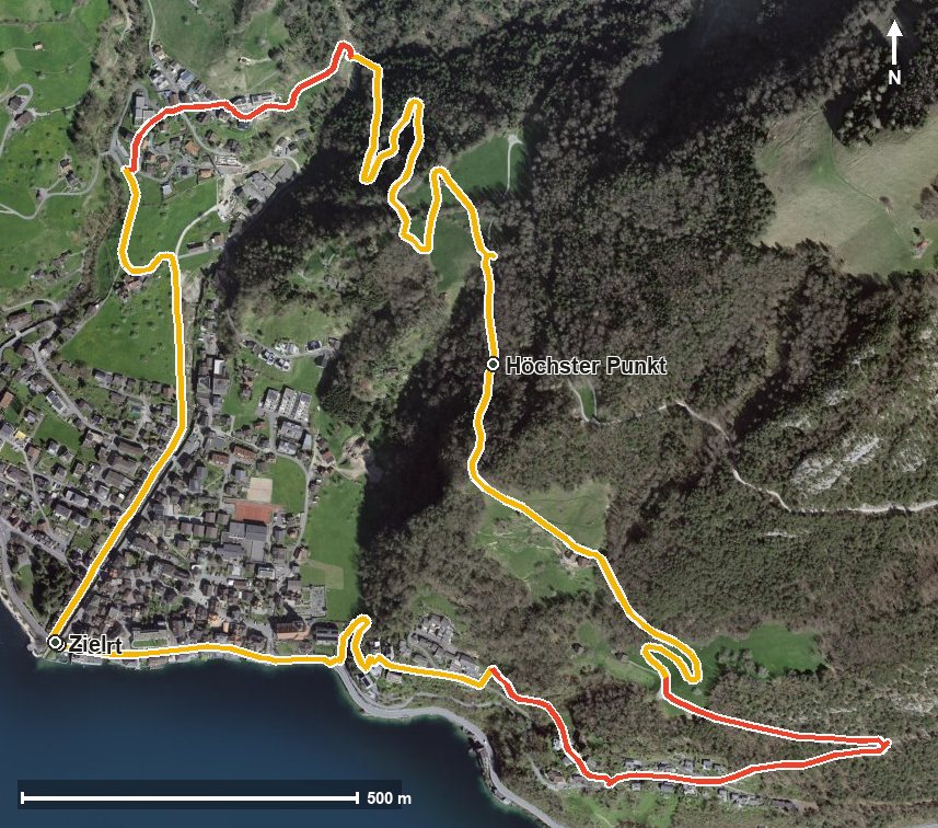
Open interactive map (zoom and pan)
Elevation profile
Route description
The starting point is Gersau by the church, where the path crosses the Innerer Dorfbach straight away. The steepest passage comes as early as kilometre 0.3 and reaches around 16 per cent.
From kilometre 1.1 the real climb begins with 180 metres of ascent. At kilometre 2.3 the Sellenweid is reached, and shortly afterwards, at kilometre 2.7, the highest point of the loop at 685 metres.
The way back descends to the lakeshore and crosses the Usserdorfbach at kilometre 4.4 before returning to the starting point.
Some sections require a sure step and sturdy footwear, but technically the path remains manageable. Because the loop stays low, it can be walked over a long season from March to November. No refreshment stop is recorded along the route, but food and drink are available in Gersau.
Grading
Good to know
Getting there / public transport
By public transport or boat to Gersau; the loop starts at the church. Current timetable at sbb.ch.
Food and drink
There is no place to stop for refreshments along the loop. Food and drink are available in Gersau at the start and finish.
Best time of year
Recommended: Mar, Apr, May, Jun, Jul, Aug, Sep, Oct, Nov