From Einsiedeln over the Katzenstrick to Rothenthurm
4.5 kilometres with 179 metres of ascent: this short link leads from Einsiedeln station at 880 metres over the Katzenstrick across to Rothenthurm. An hour and a half with an elevation range of just 173 metres.
The route from above
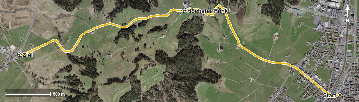
Open interactive map (zoom and pan)
Elevation profile
Route description
The starting point is Einsiedeln station, which makes getting there particularly easy. The path crosses the Wänibach straight away and the Rotenbach at kilometre 1.0.
From kilometre 0.9 the only climb begins with 166 metres of ascent; the steepest section is 21 per cent at kilometre 1.6. Via Albegg the Katzenstrick is reached at kilometre 2.0, and at kilometre 2.3 lies the highest point at 1,053 metres.
The path then descends via the Aubach, Unter Günzli, the Schlüssel and the Äussere Altmatt and crosses the Chlausenbach at kilometre 4.5. The hike ends in Rothenthurm at 918 metres.
Technically the route makes no particular demands and is therefore suitable for families too. Because it stays comparatively low, it can be walked from March to November. Both ends lie on the railway line, which makes planning easier.
Grading
Good to know
Getting there / public transport
By public transport to Einsiedeln; the hike starts right at the station. Current timetable at sbb.ch.
Food and drink
No refreshment stop is recorded along the route. Food and drink are available in Einsiedeln at the start and in Rothenthurm at the finish.
Best time of year
Recommended: Mar, Apr, May, Jun, Jul, Aug, Sep, Oct, Nov